RAF Barkston Heath
United Kingdom /
England /
Grantham /
World
/ United Kingdom
/ England
/ Grantham
World / United Kingdom / England
military airbase, military, RAF - Royal Air Force, training center
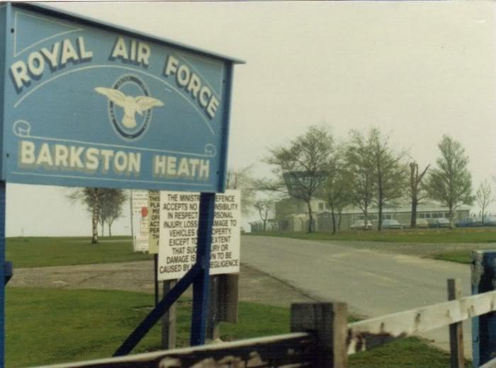
RAF Barkston Heath (IATA: N/A, ICAO: EGYE) is a Royal Air Force station near Grantham, Lincolnshire.
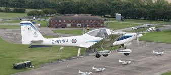
The primary function of RAF Barkston Heath is as a Relief Landing Ground for the flying training activities at RAF Cranwell. It is a regular home to only one unit, the Joint Elementary Flying Training School which operates 18 Mk II Firefly two seat trainers.
The Defence Elementary Flying Training School, provides elementary flying training for Royal Navy and Army Air Corps students. The RAF Barkston Heath detachment comprises 703 Naval Air Squadron and 674 Squadron Army Air Corps and is supported by a civilian contract with Babcock plc. The school operates the Slingsby Firefly T67M260, a well-proven aircraft for the role of preparing military students for the intense training required to become an effective front line pilot.The distinctive black and yellow aeroplanes are a common sight above the skies of Lincolnshire.
www.raf.mod.uk/rafcranwell/aboutus/rafbarkstonheath.cfm
Wikipedia article: http://en.wikipedia.org/wiki/RAF_Barkston_Heath
Nearby cities:
Coordinates: 52°57'46"N -0°33'35"E
- RAF Wittering 38 km
- Former RAF Wainfleet (Range) 55 km
- RAF Donna Nook (Range) 75 km
- Former RFC/RAF Thetford 107 km
- RAF Kinloss 557 km
- RAF Tain - Defence Training Estates 586 km
- Royal Air Force (RAF) Akrotiri 3330 km
- Al Udeid Air Base 5282 km
- Camp Bastion 5587 km
- RAF Mount Pleasant (MTN/EGYP) 12850 km
- Former Bloodhound Missile Site 0.5 km
- Sudbrook 3 km
- Welby 3.3 km
- Belton House & Park 4.4 km
- Belton Park Golf Course 5 km
- Alma Park Industrial Eatste 5.4 km
- De Vere Belton Wood Resort & Hotel 5.8 km
- Hall's Hill 6.6 km
- Marston Solar Field 8.9 km
- Allington Solar Field 9 km