RAF Donna Nook (Range)
United Kingdom /
England /
Tetney /
World
/ United Kingdom
/ England
/ Tetney
World / United Kingdom / England
RAF - Royal Air Force, draw only border, firing range

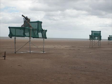
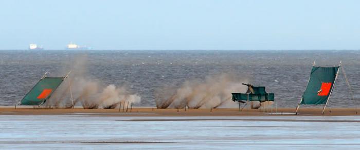

RAF Donna Nook is a bombing range in East Lindsey in north-east Lincolnshire in England. It is maintained by the RAF and used by British and NATO war planes.
North of the village of North Somercotes. The area is salt marsh, and is used by the numerous Royal Air Force bases in Lincolnshire for bombing practice; known as RAF Donna Nook. The resident wildlife fare surprisingly well, and seem to have become accustomed to aircraft bombing near them on a regular basis.
www.raf.mod.uk/organisation/stations.cfm?selectStation=...
Wikipedia article: http://en.wikipedia.org/wiki/Donna_Nook
Nearby cities:
Coordinates: 53°29'17"N 0°8'35"E
- Hornsea 2 Wind Farm 102 km
- Hornsea One Wind Farm 113 km
- Hornsea 3 Offshore Wind Farm 144 km
- Texel (municipality) 300 km
- Vlieland (municipality) 311 km
- Hollands Kroon 311 km
- Terschelling (municipality) 327 km
- Harlingen (municipality) 330 km
- Súdwest Fryslân 336 km
- Lelystad (municipality) 341 km
- Conisholme Wind Farm 8 km
- Covenham Reservoir 9 km
- Humberston Fitties 10 km
- Tetney oil depot 10 km
- Thorpe Park 10 km
- Spurn Head 14 km
- Theddlethorpe Gas Terminal Former Viking Gas Terminal 15 km
- Gas depot 19 km
- Park Resorts Withernsea Sands Holiday Park 29 km
- Humber Estuary 33 km
Comments