Namur
Belgium /
Namur /
World
/ Belgium
/ Namur
/ Namur
World / Belgium / Wallonie / Namur / Namur
city, capital city of state/province/region, draw only border
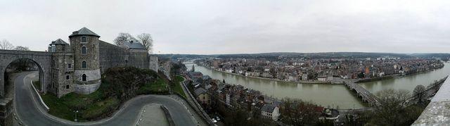
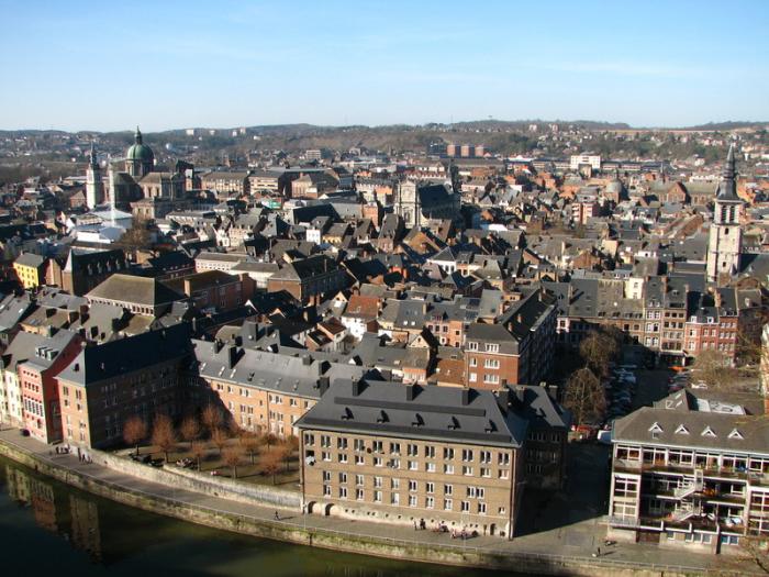
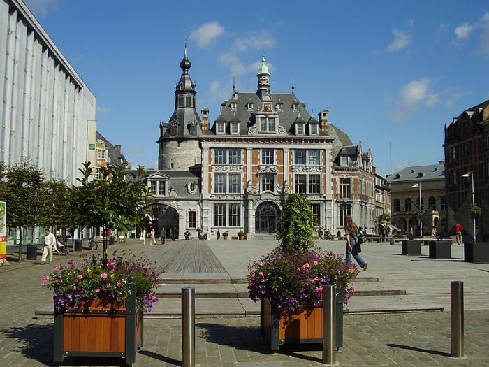
Namur (French pronunciation: [namyʁ], Dutch: Namen, Nameur in Walloon) is a city and municipality in Wallonia, in southern Belgium. It is both the capital of the province of Namur and (since 1986) of Wallonia. It hosts the Walloon Parliament.
Namur stands at the confluence of the Sambre and Meuse rivers and straddles three different regions – Hesbaye to the north, Condroz to the south-east, and Entre-Sambre-et-Meuse to the south-west. The language spoken is French.
www.namur.be/?lng=en&page=
www.wallonie.be/en/index.html
Namur stands at the confluence of the Sambre and Meuse rivers and straddles three different regions – Hesbaye to the north, Condroz to the south-east, and Entre-Sambre-et-Meuse to the south-west. The language spoken is French.
www.namur.be/?lng=en&page=
www.wallonie.be/en/index.html
Wikipedia article: http://en.wikipedia.org/wiki/Namur_(city)
Nearby cities:
Coordinates: 50°27'34"N 4°50'55"E
- Beauraing (Municipality) 33 km
- Doische (Municipality) 34 km
- Philippeville (Municipality) 37 km
- Genappe (municipality) 40 km
- Viroinval (Municipality) 45 km
- Gedinne 46 km
- Beaumont (municipality) 52 km
- Chimay (Municipality) 59 km
- Vresse-sur-Semois (municipality) 59 km
- Momignies 67 km
- Citadel of Namur 1 km
- Quarters Onder Luitenant Thibaut 2.5 km
- Quarters Veld van Belgrade 2.9 km
- Polygon de Sart-Hulet 3.1 km
- Geronsart castle or Ancient Abbey of Geronsart 3.2 km
- Grand Tige castle 3.4 km
- Fort van Dave 5.1 km
- Sagrex - HeidelbergCement Group 5.3 km
- Temploux Airfield 6.5 km
- Fort de Marchovelette 7.6 km