Waitemata Harbour (Auckland, NZ)
New Zealand /
Auckland /
North Shore /
Auckland, NZ
World
/ New Zealand
/ Auckland
/ North Shore
World / New Zealand / Waikato / Waikato
water, invisible, harbour


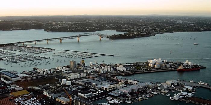
Waitemata Harbour is the main access by sea to Auckland, New Zealand.
Wikipedia article: http://en.wikipedia.org/wiki/Waitamata_Harbour
Nearby cities:
Coordinates: 36°49'42"S 174°43'53"E
- Tamaki Strait 22 km
- Manukau Harbour 23 km
- Waiuku River 35 km
- Firth of Thames 50 km
- Coromandel Harbour 63 km
- Lake Whangapa 73 km
- Lake Waikare 74 km
- Whangapoua Harbour 79 km
- Whitianga Harbour 83 km
- Mercury Bay 87 km
- Birkenhead [suburb] 1.2 km
- Northcote Point 1.6 km
- Herne Bay [suburb] 1.7 km
- St Mary's Bay [suburb] 2.1 km
- Northcote [suburb] 2.9 km
- auckland 3.5 km
- Auckland City Central Business District 3.8 km
- 18 Knot Exemption Zone 4.1 km
- Bayswater [suburb] 4.6 km
- Waitematā Harbour Restricted Zone 4.7 km