88CA Regional Medical Center San Jose H2 Heliport (San Jose, California)
USA /
California /
Alum Rock /
San Jose, California
World
/ USA
/ California
/ Alum Rock
World / United States / California
heliport, helipad


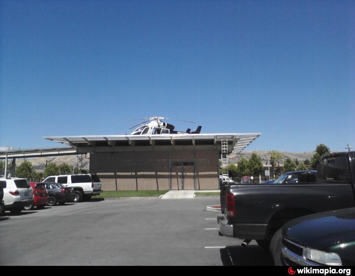
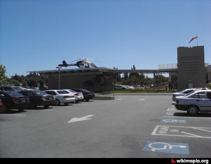
Helipad H1
Dimensions: 54 x 54 ft. / 16 x 16 m
Surface: ROOF/TOP, in good condition
METAL
Runway edge lights: PERI
Latitude: 37-21.686833N
Longitude: 121-50.906667W
Elevation: 120.0 ft.
Traffic pattern: left left
FAA Identifier: 88CA
Regional Medical Center of San Jose
www.airnav.com/airport/88CA
Dimensions: 54 x 54 ft. / 16 x 16 m
Surface: ROOF/TOP, in good condition
METAL
Runway edge lights: PERI
Latitude: 37-21.686833N
Longitude: 121-50.906667W
Elevation: 120.0 ft.
Traffic pattern: left left
FAA Identifier: 88CA
Regional Medical Center of San Jose
www.airnav.com/airport/88CA
Nearby cities:
Coordinates: 37°21'41"N 121°50'54"W
- Emergency Air Lift 73 km
- San Rafael Heliport (Private) 86 km
- CHP 101 km
- Big Hill Heliport 6155 208 km
- 7CL4 Marine Corps Mountain War Training Center Heliport 233 km
- military helicopters 309 km
- 5CN5 Palmaz Ranch Heliport 312 km
- 5Q2 USFS Chester Heliport 330 km
- Helicopter landing area 354 km
- Heliport 384 km
- Regional Medical Center of San Jose 0.1 km
- Overfelt Gardens 0.7 km
- Independence High School 1.2 km
- Capitol Square Mall 1.3 km
- Little Portugal 1.5 km
- Rancho del Pueblo Golf Course 1.8 km
- Penitencia Creek County Park 2.2 km
- Saigon Business District, San Jose 3.5 km
- Reid Hillview Airport (RHV/KRHV) 4 km
- Santa Clara County, California 11 km