Bayazıt Fortress
Turkey /
Agri /
Dogubeyazit /
World
/ Turkey
/ Agri
/ Dogubeyazit
World / Turkey / Agri
fortress, interesting place
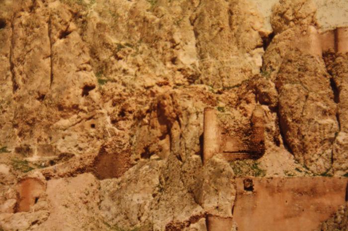
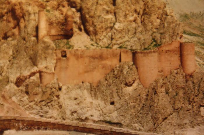
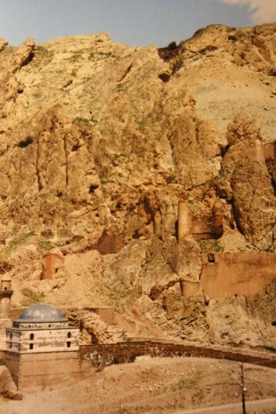

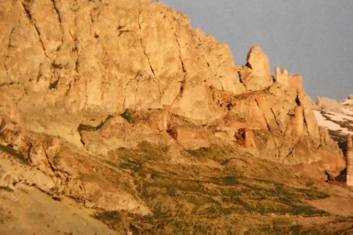
Daroynk' or Bayazet was old Armenian fortress. The fortress of " Tariuni " has had a rich history with monuments dating back to the time of the Araratian Kingdon (known also as Urartu) . At IV century A.D. there was a prominent defencive fortress of " Daroynk' " in Bagratid Armenia's kingdom. Before the Ottoman Empire the site was referred to by its Armenian name, Daroynk'. In the 4th century the Sasanians failed to capture the Armenian stronghold and royal treasury at Daroynk. Princes of the Bagratid dynasty of Armenia resided at Daroynk and rebuilt the fortress. It was subsequently conquered by Persians, Romans, Arabs, and Byzantines all of whom would have used the plain to rest and recoup during their passages across the mountains. Turkish peoples arrived in 1064, but were soon followed by the Mongols and further waves of Turks. The castle of Daroynk was built and rebuilt many times throughout this history, although it is now named after the Turkish warlord Celayırlı Şehzade Bayazıt Han who ordered one of the rebuildings (in 1374). Ultimately, the town was renamed Beyazit itself in the 16th century. After its conquest by the Ottoman Empire in 1514 the area was ruled by Turkish generals, later including İshakpaşa, who built the palace that still bears his name. The town saw fighting in the Ottoman–Persian War (1821–23), was attacked by Russia in 1856, and taken by the Russians during the Russo-Turkish War (1877–78). When the Russians retreated many of the Armenian population left with them to build New Beyazit (now Gavar at Armenia) on the shore of lake Sevan. During the Armenian genocide ( 1915-1923 ) Armenian population of Bayazet nearly 12 thousand people ( 93% of entire population ) was massacred by Turks, part of them fled to Eastern Armenia. After that it was populated by Kurds in 1930, when the Turkish army destroyed it. A new town was built in the plain below the old site in the 1930s (hence the new name "Doğubeyazıt" which literally means "East Beyazıt").
Nearby cities:
Coordinates: 39°31'16"N 44°7'58"E
- Dzoghkert / Menuakhinili 49 km
- Turkey's most eastern point 58 km
- Old Bagaran 87 km
- Adır (Lim) Island 100 km
- Ruins of Ani 120 km
- Lchashen 132 km
- Bulanik (Kop) 169 km
- summer houses 175 km
- Karaurgan Nahiyesi 183 km
- Bagramoghli villas (ruins) 187 km
- Zen Vadisi 3.6 km
- 1st Mechanized Infantry Brigade 3.8 km
- Sağdıç 5.8 km
- Doğubayazıt District 16 km
- Tendürek Mountain 29 km
- Iğdır Province 41 km
- Çaldıran District 45 km
- Ağrı Province 64 km
- Aras Mountains 110 km
- Van Province 118 km