Needle's Eye Road Underpass
USA /
Vermont /
Morrisville /
World
/ USA
/ Vermont
/ Morrisville
World / United States / Vermont
underpass, railway bridge
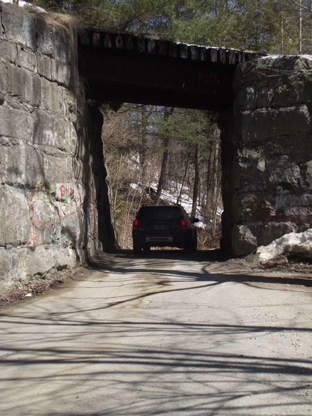
Is it any wonder that they named this road for the nature of the rail bridge it passes under?
One approaches an underpass just barely wide enough for one vehicle, at an angle, slowing to a stop to see if anyone is coming from the opposite direction.
One approaches an underpass just barely wide enough for one vehicle, at an angle, slowing to a stop to see if anyone is coming from the opposite direction.
Nearby cities:
Coordinates: 44°34'38"N 72°36'21"W
- Railway bridge 66 km
- Saint-Lawrence Seaway bridge no. 10 at Valleyfield, QC 139 km
- Maiden Lane Bridge (former) 234 km
- Alfred H. Smith Memorial Bridge 249 km
- Québec Bridge 263 km
- Abandoned ROW of Southern New England Railroad 269 km
- Moodna Viaduct 370 km
- Howland Junction 479 km
- Canadian Pacific Railway through Lindsay (GB&S & LB&P) 488 km
- Former Rail Spur 491 km
- Morristown, Vermont 5.2 km
- Hyde Park, Vermont 6.6 km
- Johnson, Vermont 10 km
- Elmore, Vermont 12 km
- Stowe, Vermont 14 km
- Cambridge, Vermont 18 km
- Worcester, Vermont 19 km
- Hardwick, Vermont 21 km
- Woodbury, Vermont 22 km
- Duxbury, Vermont 35 km