Gouden-Handstraat, 1 (Bruges)
Belgium /
West-Flandern /
Brugge /
Bruges /
Gouden-Handstraat, 1
World
/ Belgium
/ West-Flandern
/ Brugge
World / Belgium / Vlaanderen / West-Vlaanderen / Brugge
house, listed building / architectural heritage
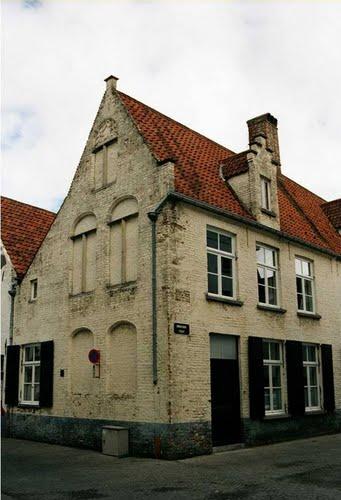
17th Century House with remarkable facade towards the Oostgistelhof street.
Nearby cities:
Coordinates: 51°12'49"N 3°13'32"E
- Kortewinkel, 15 0.1 km
- Consulate of Genoa and home of the consul 0.3 km
- Liberty of Bruges 0.5 km
- Moeder Babelutte 0.7 km
- Relais Bourgondisch Cruyce 0.7 km
- Sint-Leocollege 0.3 km
- Historical Centre of Bruges 0.4 km
- Belfry and Halles 0.6 km
- Burg Square 0.6 km
- Grote Markt 0.6 km
- Kempinski Hotel Dukes' Palace 0.7 km
- Hof Sebrechts 0.7 km
- Sint-Jozefinstituut 0.8 km
- Koningin Astridpark 0.9 km
- Kristus Koning 1 km