Mauna Kea
USA /
Hawaii /
Paauilo /
World
/ USA
/ Hawaii
/ Paauilo
World / United States / Hawaii
mountain, volcano, National Natural Landmark


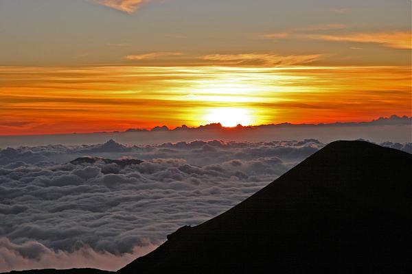

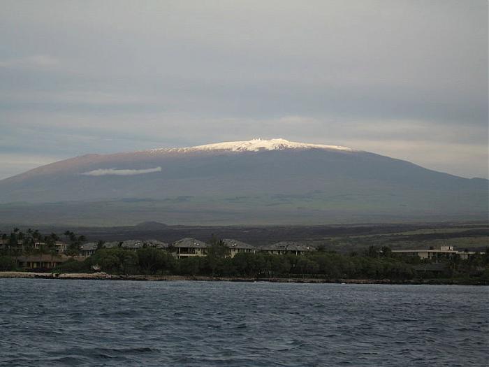
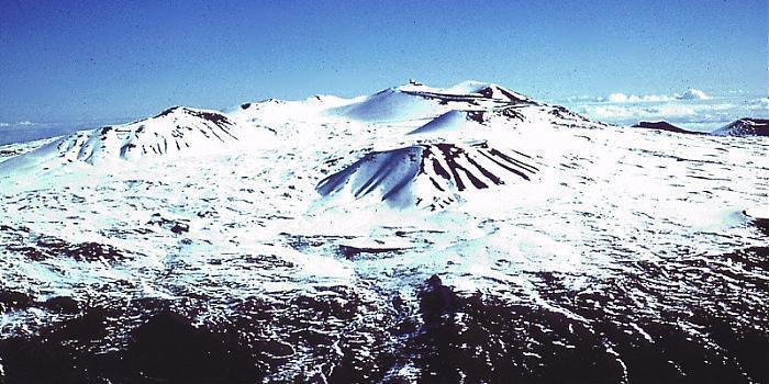
Mauna Kea, the 4,207 m (13,802 ft) dormant volcano in the Hawaiian Islands, one of five volcanic peaks that together form the island of Hawaii. It is the tallest mountain in the world when measured from base to peak, its base being some 19,678 feet (5998 m) under the surface of the Pacific Ocean, which would bring its total height to 33,474 feet (10,203 m). In Hawaiian, mauna kea means "white mountain", a reference to the fact that it is regularly snow- or frost-capped during the northern hemisphere winter. Its highest point, Puu Wekiu (one of numerous cinder cones on the summit), is the highest point in the state of Hawaii at 13,796 feet (4,205 m).
peakbagger.com/peak.aspx?pid=11909
www.topoquest.com/map.php?lat=19.82061&lon=-155.46813&d...
peakbagger.com/peak.aspx?pid=11909
www.topoquest.com/map.php?lat=19.82061&lon=-155.46813&d...
Wikipedia article: http://en.wikipedia.org/wiki/Mauna_Kea
Nearby cities:
Coordinates: 19°48'39"N 155°28'24"W
- Hawaii Volcanoes National Park 34 km
- Mauna Loa 35 km
- Kīlauea East Rift Zone 43 km
- Loʻihi Seamount 87 km
- Kiholo Ridge 95 km
- Indianapolis Seamount 143 km
- Day Seamount 158 km
- Penguin Bank 282 km
- Wai'anae Slump 387 km
- Nero Seamount 2480 km
- Mauna Kea Forest Reserve 4.3 km
- Humuula-Upper Piihonua Hawaiian Home Land 8.2 km
- Pohakuloa Training Area 20 km
- Hilo Forest Reserve - Watershed Section 23 km
- Keamuku Maneuver Area 24 km
- Kīpuka ‘Āinahou Nēnē Sanctuary 24 km
- Mauna Loa Forest Reserve 25 km
- Hawai‘i 25 km
- Mauna Loa 1859 Lava Flow 32 km
- Pu'u Wa'awa'a Cooperative Game Management Reserve 33 km
Comments