Nuneaton & Abbey Green Information Board (Nuneaton)
United Kingdom /
England /
Nuneaton /
Abbey Green
World
/ United Kingdom
/ England
/ Nuneaton
World / United Kingdom / England
tourist information board
Add category
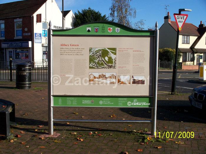
This is the Nuneaton & Abbey Green Information Board in the Abbey Green area of Nuneaton, it has the historic information for both the Nuneaton town in general & Abbey Green. It displays two old maps, one for the whole of Nuneaton and one for the Abbey Green area how it was in the past. It especially has a few old photos of noticeable buildings in the Abbey Green area.
Nearby cities:
Coordinates: 52°31'38"N 1°28'29"W
- Bridgnorth 66 km
- Prom Coffee Shop and Tourist Information Centre 167 km
- Tourist Information Office 321 km
- Glendalough Visitor Centre & Car Park 331 km
- Skerries Mill 331 km
- Edinburgh tour bus stop 397 km
- Loch Lomond Shores 437 km
- Waterville Tourist Information Office 599 km
- Hof 1733 km
- Esjan 1742 km
- Abbey 0.2 km
- Judkins Quarry 1.2 km
- Weddington (suburb) 1.2 km
- Bar Pool 1.3 km
- Canal Farm 1.3 km
- Camp Hill 1.8 km
- Weddington 1.8 km
- Stockingford 2.1 km
- Hartshill 3.2 km
- Warwickshire 25 km