Suffolk Downs (MBTA) (Boston, Massachusetts)
USA /
Massachusetts /
Winthrop /
Boston, Massachusetts
World
/ USA
/ Massachusetts
/ Winthrop
World / United States / Massachusetts
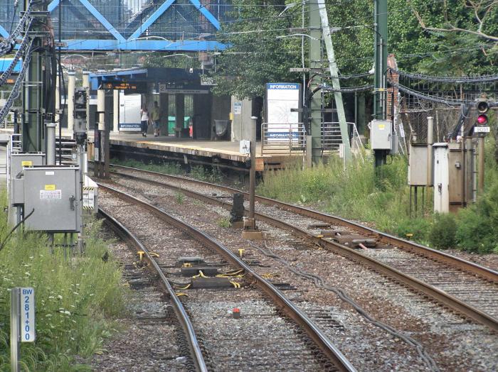
Suffolk Downs Station on the MBTA Blue Line.
Wikipedia article: http://en.wikipedia.org/wiki/Suffolk_Downs_(MBTA_station)
Nearby cities:
Coordinates: 42°23'25"N 70°59'49"W
- Logan airport(KBOS) taxiway 1.9 km
- Runway 4R/22L 2.2 km
- Runway 33L/15R 2.5 km
- Squantum 10 km
- Hough's Neck (Quincy) 12 km
- Doctors Island 16 km
- Mill Cove 16 km
- Imterchange Rte 128 & I-95 / Rte 1 / Rte 129 16 km
- Little Harbor 21 km
- Oldham Pond 38 km
- East Boston 2.7 km
- Logan International Airport (BOS/KBOS) 3.1 km
- Winthrop, Massachusetts 3.9 km
- Deer Island Sewage Treatment Plant 5.4 km
- South Boston 6.6 km
- Nahant, Massachusetts 7.2 km
- Long Island 8.2 km
- Peddocks Island 12 km
- Swampscott, Massachusetts 13 km
- Cohasset, Massachusetts 22 km