Kryva Hora
Ukraine /
Kyyivska /
Prypyat /
World
/ Ukraine
/ Kyyivska
/ Prypyat
, 11 km from center (Припьять)
World / Ukraine / Kiev
wildfire affected area, ghost town


This village is uninhabited due to the Chernobyl NPP disaster.
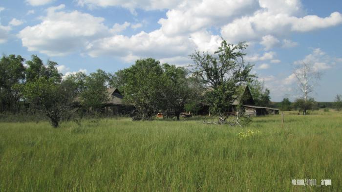
Kryva Hora was a former village in Ukraine that was evacuated due to the consequences of the Chornobyl disaster. It was located in the Ivankiv district of Kyiv Oblast.
To the north, Kryva Hora was surrounded by a horseshoe-shaped hill, which is the origin of the village’s name. The exact time of its founding is unknown.
Before the Chornobyl disaster, it was part of the Chornobyl district and, until the mid-1970s, served as the center of a village council. Later, the village council was dissolved, and by 1986, the village was administratively subordinate to the Zymovyshche village council.
On the eve of the Chornobyl disaster, Kryva Hora had a population of 300 residents. After the accident, the inhabitants were relocated to the villages of Lukashi and Rudnytske in the Baryshivka district.
Nearby cities:
Coordinates: 51°23'0"N 30°11'58"E
- Chornobyl 10 km
- Tovstyi Lis 29 km
- Denysovychi 38 km
- Martynovychi 44 km
- Novyi Myr 45 km
- Oshytky 49 km
- Buda-Varovychi 51 km
- Vilcha 57 km
- Chernyn 58 km
- Poliske 60 km
- Prirva Lake 1.3 km
- Lake Starukha 2.8 km
- Polovetski Hory 2.8 km
- Starosillia 3.4 km
- Pereval Firth 3.9 km
- Electric power lines 4 km
- Cooling pond 4.2 km
- Chernobyl Cooling Pond Island 4.4 km
- Zhyrvanka Forest 4.7 km
- Chornobyl Exclusion Zone 22 km