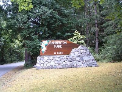
Bamberton Provincial Park
Canada /
British Columbia /
Cowichan Valley /
Glen Lane
World
/ Canada
/ British Columbia
/ Cowichan Valley
World / Canada / British Columbia / Cowichan Valley
park, campsite / caravan site
Bamberton Park was given to the province by the British Columbia Cement Company in 1959. The name Bamberton was chosen by the donors and commemorates H.K. Bamber, managing director of the British Portland Cement Manufacturing Company, a predecessor of the BC Cement Company, now known as Ocean Cement.
Traditionally, local First Nations used Johns Creek, which runs through the park, for trout fishing and still utilize the area today for ceremonial purposes in the fall and winter.
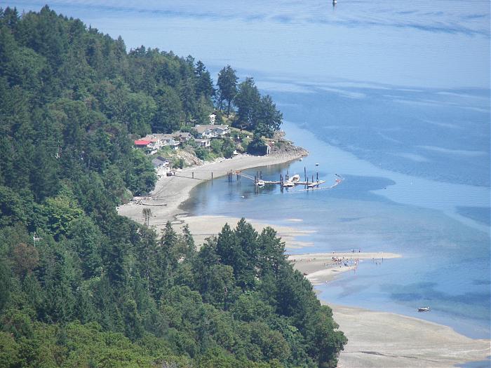
Bamberton protects a mixed woodland of second-growth Douglas fir and arbutus, a salmon-bearing creek and eel-grass beds in the estuary. Over time, natural weathering forces may return the creek outflow area to a floodplain with salt marsh communities. The park also features an interesting intertidal zone, popular with school groups who visit the park to study the marine life.
The campground at Bamberton Park is wheelchair accessible. The route from the parking lot at the day use area to the beach is wheelchair accessible and paved; some portions are steep. Toilet facilities are also wheelchair accessible.
www.env.gov.bc.ca/bcparks/explore/parkpgs/bamberton
Traditionally, local First Nations used Johns Creek, which runs through the park, for trout fishing and still utilize the area today for ceremonial purposes in the fall and winter.
Bamberton protects a mixed woodland of second-growth Douglas fir and arbutus, a salmon-bearing creek and eel-grass beds in the estuary. Over time, natural weathering forces may return the creek outflow area to a floodplain with salt marsh communities. The park also features an interesting intertidal zone, popular with school groups who visit the park to study the marine life.
The campground at Bamberton Park is wheelchair accessible. The route from the parking lot at the day use area to the beach is wheelchair accessible and paved; some portions are steep. Toilet facilities are also wheelchair accessible.
www.env.gov.bc.ca/bcparks/explore/parkpgs/bamberton
Wikipedia article: http://en.wikipedia.org/wiki/Bamberton_Provincial_Park
Nearby cities:
Coordinates: 48°36'22"N 123°31'40"W
- Gowlland Tod Provincial Park 4.4 km
- Thetis Lake Regional Park 13 km
- Sidney Spit (Gulf Islands National Park Reserve) 14 km
- Koksilah Provincial Park 18 km
- Burgoyne Bay Provincial Park 22 km
- Stuart Island State Park 23 km
- Ruckle Provincial Park 23 km
- Mount Maxwell Ecological Reserve 25 km
- Gulf Islands National Park Reserve 32 km
- Belle Chain Islets 34 km
- CBCV-FM / CBUX-FM-1 1.7 km
- Saanich Inlet 2.1 km
- Bamberton Quarry (abandoned) 2.2 km
- Senanus Island 3.5 km
- Oliphant Lake 3.7 km
- Rat Lake 3.8 km
- Spectacle Lake 4.4 km
- Willis Point 5 km
- Brentwood Bay 5.2 km
- North Saanich 8.4 km