Westhaven Marina (Auckland, NZ)
New Zealand /
Auckland /
Auckland, NZ
World
/ New Zealand
/ Auckland
/ Auckland
World / New Zealand / Auckland / Waitakere
marina, draw only border
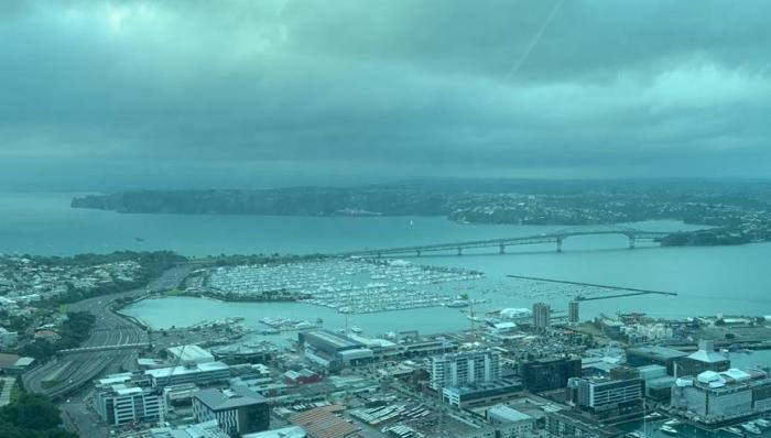
During the 1950s the foreshore of St. Mary’s bay disappearred under the approaches to the Harbour Bridge under construction [opened 1959].
Cut off from the sea a great number of small commercial boat-yards are forced to close and many private boat-slips which have been used for almost a century fell into disuse. The Auckland Harbour Board planned to fill in Westhaven completely, but a group of local residents including engineers and architects donated their services to create Westhaven Marina, now one of Auckland’s greatest assets. If it were not for them this entire area wouls simply be a continuation of the industrial waterfront areas to the east.
Cut off from the sea a great number of small commercial boat-yards are forced to close and many private boat-slips which have been used for almost a century fell into disuse. The Auckland Harbour Board planned to fill in Westhaven completely, but a group of local residents including engineers and architects donated their services to create Westhaven Marina, now one of Auckland’s greatest assets. If it were not for them this entire area wouls simply be a continuation of the industrial waterfront areas to the east.
Nearby cities:
Coordinates: 36°50'16"S 174°44'52"E
- Port Nelson 508 km
- Horizon Shores Marina 2247 km
- Martha Cove 2619 km
- Gladstone Marina 2672 km
- Mackay Marina 3024 km
- Gulf Point Marina 3262 km
- Lincoln Cove Marina 3495 km
- Bayview 5142 km
- Komando Armada Timur / Lantamal V Surabaya 7058 km
- Victoria & Alfred Waterfront 11789 km
- Herne Bay [suburb] 1.5 km
- Waitemata Harbour 1.8 km
- Auckland City Central Business District 2.1 km
- Birkenhead [suburb] 2.6 km
- 18 Knot Exemption Zone 2.7 km
- Waitematā Harbour Restricted Zone 3.2 km
- Ngataringa Bay 3.6 km
- Northcote [suburb] 3.8 km
- Bayswater [suburb] 3.9 km
- Shoal Bay 4 km
Comments