Ketapang Ferry Port (Banyuwangi City)
Indonesia /
Jawa Timur /
Banyuwangi /
Banyuwangi City /
Jl. Gatot Subroto
World
/ Indonesia
/ Jawa Timur
/ Banyuwangi
World / Indonesia / Bali
ferry terminal
Add category

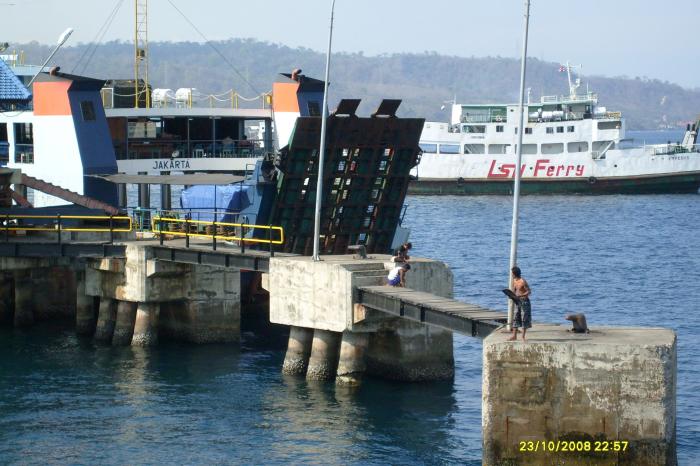
Connecting Java and Bali via sea transportation (Bali Strait). Ports can be reached by passing through Jalan Gatot Subroto. Ports have been tourists who want to the island of Bali using a landline.
Every day, hundreds of ferry boat ride airport flow of passengers and vehicles to and from the island of Bali via Gilimanuk in Bali.
The average duration of trips required between Ketapang - Gilimanuk or otherwise with this ferry is about 1 hour.
Every day, hundreds of ferry boat ride airport flow of passengers and vehicles to and from the island of Bali via Gilimanuk in Bali.
The average duration of trips required between Ketapang - Gilimanuk or otherwise with this ferry is about 1 hour.
Wikipedia article: https://en.wikipedia.org/wiki/Port
Nearby cities:
Coordinates: 8°8'35"S 114°24'1"E
- Lembar Port 195 km
- Tanjung Priok Harbor 862 km
- Dermaga Ancol 866 km
- Muara Angke Ferry Port (a.k.a. Kali Adem Port) 873 km
- Pelabuhan Fery Torobulu ke Tampo Muna 981 km
- Tanjung Api Api Ferry Port 1242 km
- Webb dock east 4508 km
- Circular Quay 4733 km
- Picton Ferry Terminal 6899 km
- Clifford Bay Ferry terminal site 6924 km
- Depot Pertamina UPMS V Tanjung Wangi 0.9 km
- BALLOON LOOP STASIUN KETAPANG 1.5 km
- Pelabuhan Tanjung Wangi 1.7 km
- PT. INKA (Industri Kereta Api) Banyuwangi 1.9 km
- Bali Strait 2.1 km
- PERKEBUNAN 3.4 km
- Balai Perikanan Banyuwangi 8.3 km
- West Bali National Park 8.5 km
- Buleleng Regency 60 km
- Bali 82 km