Link Island
Canada /
British Columbia /
Ladysmith /
World
/ Canada
/ British Columbia
/ Ladysmith
island
Add category
Connected to Mudge Island at all but highest high tides. At high tide there are boulders to catch the unwary. Do not anchor or go between islands. You will need a kayak or canoe to go between Link and De Courcy Island at high tide.
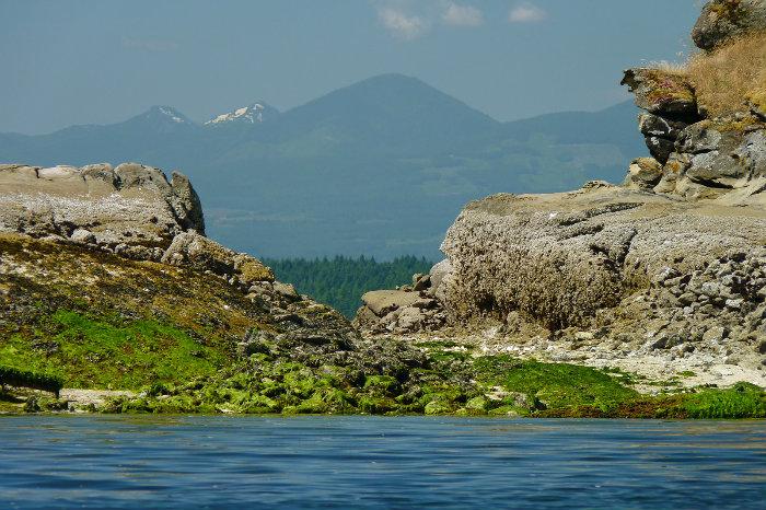
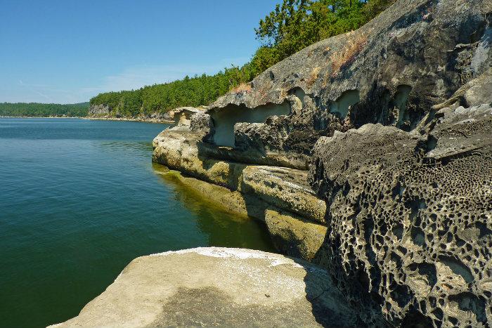
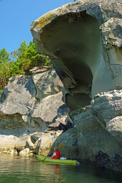
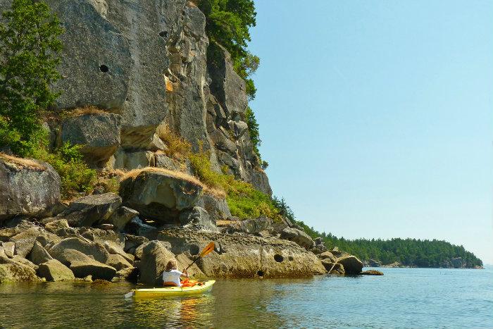
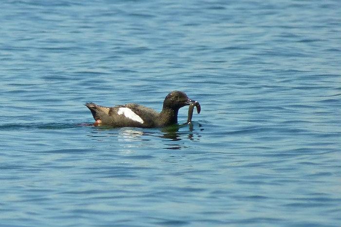
The first photo shows the gap between Link and DeCourcy, it's an easy 50-metre portage at low tide. The next 3 photos show the fantastic shoreline along the SW side of the island, and the last shows one of the many Pigeon Guillemots that nest in the cliffs.
The first photo shows the gap between Link and DeCourcy, it's an easy 50-metre portage at low tide. The next 3 photos show the fantastic shoreline along the SW side of the island, and the last shows one of the many Pigeon Guillemots that nest in the cliffs.
Nearby cities:
Coordinates: 49°7'0"N 123°45'46"W
- Texada Island 99 km
- Cortes Island 157 km
- West Redonda Island 159 km
- Quadra Island 177 km
- Sonora Island 189 km
- Nootka Island 248 km
- Cracroft Island 267 km
- Calvert Island 423 km
- Hunter Island 456 km
- Campbell Island 470 km
- Hemer Provincial Park 5.3 km
- Quennell Lake 6.3 km
- Yellowpoint Bog Ecological Reserve 7.2 km
- Cedar 7.7 km
- South Wellington 10 km
- Nanaimo Airport 11 km
- Cassidy 11 km
- Yellow Point 11 km
- Cinnabar Valley 12 km
- Strait of Georgia 22 km