Floyd Lamb State Park, aka Tule Springs (Las Vegas, Nevada)
USA /
Nevada /
Las Vegas /
Las Vegas, Nevada
World
/ USA
/ Nevada
/ Las Vegas
World / United States / Nevada
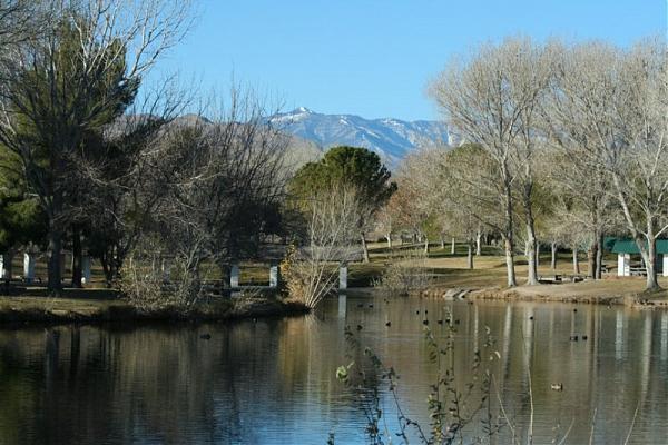
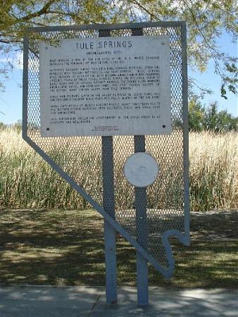
Floyd Lamb State Park was originally known as Tule Springs. This park was an early water stop for Native Americans. It later became a privately-owned working ranch, as well as a guest/dude ranch in the 1950s, where one could wait out the six-week Nevada residency requirement to obtain a quick divorce. In addition to the Tule Springs Ranch Historic Area, the park offers tree-shaded groves alongside four small fishing lakes. The park is available for day use only. Facilities include picnic areas with tables and grills, restrooms, group areas and a walking/bicycle path that winds through the park. Floyd Lamb State Park is located ten miles north of Las Vegas, via U.S. 95 to Durango and then Tule Springs Road. parks.nv.gov/fl.htm
Wikipedia article: http://en.wikipedia.org/wiki/Floyd_Lamb_State_Park
Nearby cities:
Coordinates: 36°19'25"N 115°16'0"W
- Las Vegas & Tonopah railbed (abandoned) 1.8 km
- June Bug Mine 10 km
- Lower White Blotch Spring 12 km
- Gass Peak 12 km
- Upper White Blotch Spring 12 km
- White Spot Spring 13 km
- Intersection Mormon Well Road and Gass Peak Road 13 km
- Looking North from on top. 16 km
- Quail Spring 19 km
- Pine Nut Road X Marks the Spot 27 km
- Floyd Lamb State Park 0.5 km
- Silverstone Ranch Community Association 1.7 km
- Skye Canyon Master Planned Community 3.9 km
- Iron Mountain Ranch Master Association 4.8 km
- Clark County Shooting Complex 5.3 km
- Castle Rock Hills 8.1 km
- Fossil Ridge 14 km
- Las Vegas Dunes 30 km
- Hidden Valley 34 km
- Sheep Range 52 km