Old Bridge
United Kingdom /
England /
Wadebridge /
Molesworth Street
World
/ United Kingdom
/ England
/ Wadebridge
World / United Kingdom / England
Medieval / Middle Ages, road bridge, Grade II* Listed (UK)
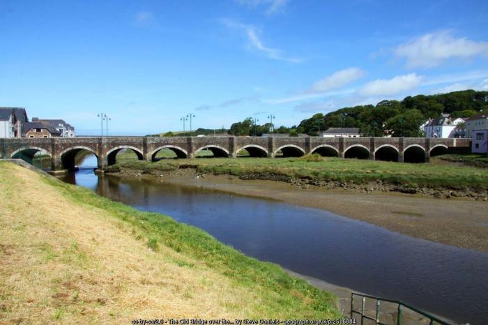
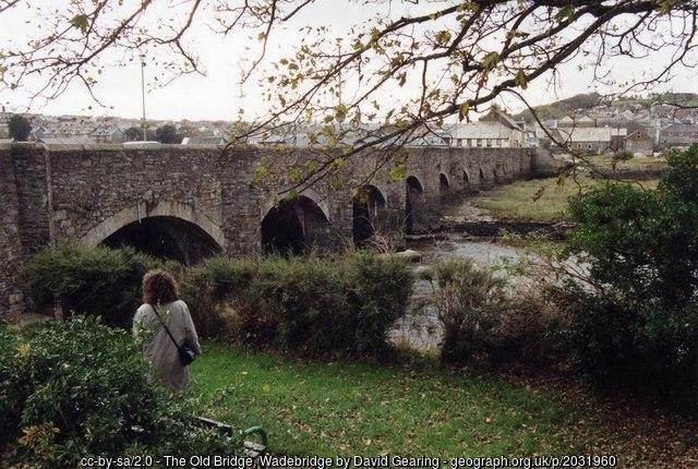
Road bridge over River Camel. Circa 1468, financed by Thomas Lovybound vicar of Egloshayle. Widened in 1847 and again in 1963, the consultant engineers Posford, Parry and Partners. Local stone rubble. Granite dressings used in the alterations of 1847 and 1963. The bridge, 320 feet long, originally had 17 arches, 12 of which visibly survive; the end arches having been built up and were used as cellars. The original pointed arches are 18 feet 6 inches wide and rise some 9 feet from the springing point. The piers are 12 feet wide with deep cutwaters between each arch, rising to form refuges in the parapets. In 1847 granite segmental arches were inserted across the cutwaters to widen the carriageway by 3 feet on either side, thereby diminishing the depth of the cutwaters. In 1963 the bridge was widened on the south east side, almost doubling the original width of the bridge. The design of the granite segmental arches of the 1847 widening was copied using rusticated granite blocks with cutwaters repeated, rising to form refuges. The bridge was mentioned by William of Worcester in his visit of 1478 and a detailed account is given by Leland (1538). The bridge originally connected 2 chapels on either side of the river, one dedicated to St Michael and the other known as King's Chapel, both of which have been demolished. Grade II* Listed: www.historicengland.org.uk/listing/the-list/list-entry/...
Photos:
1) www.geograph.org.uk/photo/2516884
2) www.geograph.org.uk/photo/2031960
Photos:
1) www.geograph.org.uk/photo/2516884
2) www.geograph.org.uk/photo/2031960
Wikipedia article: https://en.wikipedia.org/wiki/Wadebridge#History
Nearby cities:
Coordinates: 50°31'2"N 4°50'5"W
- Wadebridge Viaduct 1.1 km
- Road Bridge 29 km
- Road Bridge 38 km
- Bridge 45 km
- Road Bridge 54 km
- Road Bridge 57 km
- Road Bridge 62 km
- Road Bridge 70 km
- Road Bridge 88 km
- Ide Lane Bridge 92 km
- Royal Cornwall Showground 2.1 km
- Dinham Farm Caravan Park 3.4 km
- St Kew Golf Club 4.3 km
- St Minver Holiday Park 5 km
- Trelights 6.8 km
- Roserrow Golf and Country Club 7.1 km
- St Enodoc Golf Club 7.1 km
- Hayle Bay 8.9 km
- The Rumps 10 km
- Cornwall 11 km