Koh Ker
Cambodia /
Preah Vihear /
Tbeng Mean Chey /
World
/ Cambodia
/ Preah Vihear
/ Tbeng Mean Chey
World / Cambodia / Preah Vihéar / Kuleaen / Srayang
temple, ruins, Medieval / Middle Ages, listed building / architectural heritage

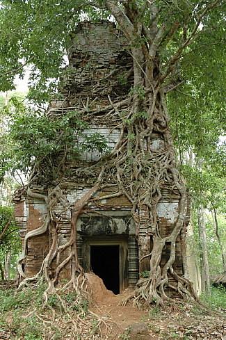
The ruins at and around Koh Ker belong to Lingapura (in Khmer, Chok Gargyar), the capital of the Khmer kings Jayavarman IV (928-941) and Harshavarman II (941-944).
helloangkor.com/attractions/koh-ker-temple-group/
helloangkor.com/attractions/koh-ker-temple-group/
Wikipedia article: https://en.wikipedia.org/wiki/Koh_Ker
Nearby cities:
Coordinates: 13°46'21"N 104°32'33"E
- Ancient city of Preah Khan Kompong Svay 42 km
- Preah Khan 45 km
- Beng Mealea 47 km
- Angkorian Temple 52 km
- Bhavapura? 107 km
- Prasat Robang Romeas Group 111 km
- Phnom Hanchey 208 km
- Phnom Pros 216 km
- Phnom Oudong ( Oudong Mountain) 221 km
- Chinese Cemetery and Khmer Temple 292 km
- Kulen 18 km
- Mount Thbeng Meanchey 39 km
- Ancient city of Mahendraparvata 49 km
- Phnom Kulen 51 km
- Phnom Kulen National Park 52 km
- Phnom Dek 72 km
- Lake Tonle Chhmar 109 km
- Tonlé Sap Lake 112 km
- Ruins of Sambor Prei Kuk / Isanapura 114 km
- Krakor 142 km