Deanery (Dublin)
Ireland /
Dublin /
Dublin /
Kevin Street Upper (R110)
World
/ Ireland
/ Dublin
/ Dublin
World / Republic of Ireland
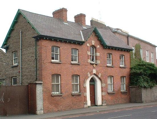
The present deanery dates from the mid-nineteenth century.
It replaced an earlier one that had been destroyed by fire.
It replaced an earlier one that had been destroyed by fire.
Nearby cities:
Coordinates: 53°20'19"N 6°16'17"W
- Iveagh Trust Buildings 0.1 km
- Revenue Commissioners Offices 0.5 km
- Dunnes Stores 0.5 km
- Portobello 0.7 km
- The Digital Hub 1.2 km
- Arnott's car park 1.3 km
- Georgian Houses 1.3 km
- ESB Head office 1.5 km
- Harwicke Street. 2.1 km
- Grangegorman 2.4 km
- Iveagh Gardens 0.8 km
- St. Stephen's Green 0.8 km
- Temple Bar 0.9 km
- Dublin City Centre 0.9 km
- St Theresa's Gardens 1 km
- The Digital Hub 1 km
- Guinness Brewery 1 km
- Georgian Quarter 1.2 km
- Ranelagh 2.3 km
- County Dublin (Contae Bhaile Átha Cliath) 7.9 km