Kakopetria
Cyprus /
Government controlled area /
Kakopetria /
World
/ Cyprus
/ Government controlled area
/ Kakopetria
World / Cyprus
village
Add category
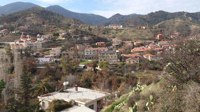
Kakopetria is a village located 55km south-west of the capital Nicosia on the north facing foothills of the Troodos Mountain range. It stands at an altitude of 667 metres and it is the highest village in the Solea valley. The community has about 1,200 permanent inhabitants but this figure multiplies in the summer months when locals flock to the mountains to avoid the hot weather of the plains. It is surrounded by thick forestland and is built on the banks of the Kargotis and Garillis rivers. The two rivers join within village itself and form the river Klarios, which crosses the Solea valley and empties into Morfou Bay.
Wikipedia article: http://en.wikipedia.org/wiki/Kakopetria
Nearby cities:
Coordinates: 34°59'8"N 32°54'12"E
- Kyperounta 5.8 km
- Astromeritis 21 km
- Kato Pyrgos 32 km
- Turkish Cypriot Exclave of Erenkoy 36 km
- Diorios (Tepebaşı) 41 km
- Kato Argaka 42 km
- Koruçam [Kormakitis , ܟܘܪܡܐܟܝܬܝܣ, Κορμακίτης] village borders 43 km
- Orga [Kayalar, Οργα] 44 km
- Livera [Sadrazamköy, Λιβερα] 47 km
- Lachi 50 km
- Troodos mountain range 2.6 km
- Amiantos mines 6.9 km
- Moutti tou Dia 7.1 km
- Μadhari Mount 8.2 km
- Adelfi Forest 8.6 km
- moutti tou kantanappi 12 km
- Mavron Oros 16 km
- Nicosia District 19 km
- Limassol District 25 km
- United Nations Green Line 30 km