Uluru - Kata Tjuta National Park
Australia /
Northern Territory /
Yulara /
World
/ Australia
/ Northern Territory
/ Yulara
World / Australia / Northern Territory
UNESCO World Heritage Site, national park
Ulum-KataTjuta National Park is included on the World Heritage List for both its natural and cultural values. Formerly called Ayers Rock- Mount Olga National Park, it is located in Australia's Red Centre. It lies in the traditional lands of the Western Desert Aboriginal people, locally known as Anangu. Anangu are part of one of the oldest human societies in the world.
The huge rock formations of Ulunj and KataTjuta and the surrounding country are part of an important cultural landscape. For Anangu these features are physical evidence of the actions, artefacts and bodies of the ancestral beings (tjulcuritja) who travelled the Earth in the creation time. These ancestors, who combined the attributes of humans and animals, journeyed across the landscape creating not only its features, but also Tjukurpa (the law)-the code of behaviour followed by Anangu today.
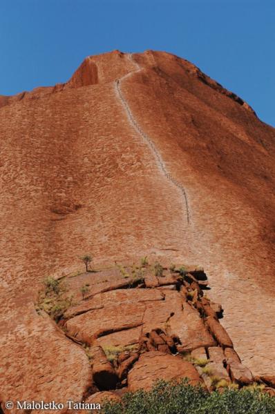
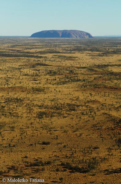
Uluru and the rock domes of KataTjuta dominate the vast red plain, dwarfing the desert oak and spinifex grass of central Australia. Uluru is composed of hard red sandstone, exposed as a result of the folding, faulting and erosion of the surrounding rock. It is 9.4 km in circumference and rises to a relatively flat top that is more than 340 m above the shallow, red sandy dunes around it. Rock art in the caves around its base provides further evidence of the enduring cultural traditions of Apangu.
The thirty-six steep-sided rock domes of Kata Tjuta, lying about 32 kilometres to the west of Uluru, are made up of gently dipping Mount Currie conglomerate. The undulating domes are interspersed with moisture-rich gullies and rocky valleys that are home to rare plants and desert animals. Like Uluru, Kata Tjuta's domes are the visible tips of huge rock slabs that extend far beneath the ground.
The park is home to twenty-one native mammals including the rare hairy-footed dunnart, the sandhill dunnartand the mulgara. More than 170 bird species, 73 species of reptile and at least 7 species of bat have been recorded in the park.
parksaustralia.gov.au/uluru/index.html
www.deh.gov.au/parks/uluru
The huge rock formations of Ulunj and KataTjuta and the surrounding country are part of an important cultural landscape. For Anangu these features are physical evidence of the actions, artefacts and bodies of the ancestral beings (tjulcuritja) who travelled the Earth in the creation time. These ancestors, who combined the attributes of humans and animals, journeyed across the landscape creating not only its features, but also Tjukurpa (the law)-the code of behaviour followed by Anangu today.
Uluru and the rock domes of KataTjuta dominate the vast red plain, dwarfing the desert oak and spinifex grass of central Australia. Uluru is composed of hard red sandstone, exposed as a result of the folding, faulting and erosion of the surrounding rock. It is 9.4 km in circumference and rises to a relatively flat top that is more than 340 m above the shallow, red sandy dunes around it. Rock art in the caves around its base provides further evidence of the enduring cultural traditions of Apangu.
The thirty-six steep-sided rock domes of Kata Tjuta, lying about 32 kilometres to the west of Uluru, are made up of gently dipping Mount Currie conglomerate. The undulating domes are interspersed with moisture-rich gullies and rocky valleys that are home to rare plants and desert animals. Like Uluru, Kata Tjuta's domes are the visible tips of huge rock slabs that extend far beneath the ground.
The park is home to twenty-one native mammals including the rare hairy-footed dunnart, the sandhill dunnartand the mulgara. More than 170 bird species, 73 species of reptile and at least 7 species of bat have been recorded in the park.
parksaustralia.gov.au/uluru/index.html
www.deh.gov.au/parks/uluru
Wikipedia article: http://en.wikipedia.org/wiki/Uluṟu-Kata_Tjuṯa_National_Park
Nearby cities:
Coordinates: 25°14'51"S 131°1'12"E
- Ningaloo Reef 1826 km
- Lorentz National Park 2481 km
- Selous Game Reserve 10163 km
- Ngorongoro Conservation Area 10516 km
- Serengeti National Park 10671 km
- Virunga National Park 11269 km
- Kahuzi-Biéga National Park 11297 km
- Maiko National Park 11449 km
- Salonga National Park (North) 12008 km
- Salonga National Park (South) 12038 km
- Connellan Airport 8.4 km
- Mutitjulu 12 km
- Kata Tjuta / Mount Olga 27 km
- Valley of the Winds 28 km
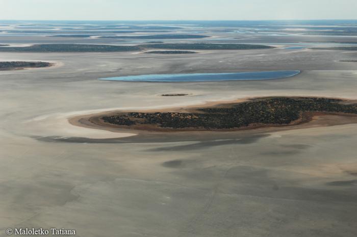
- Lake Amadeus 57 km
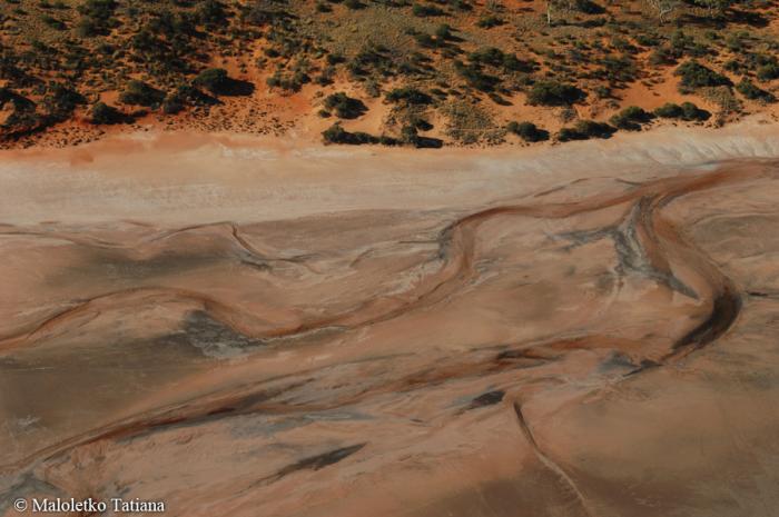
- Salt lakes 88 km
- Mount Conner (Attila) 93 km
- Amata 101 km
- Mount Woodroffe 140 km
- Pukatja 161 km