Mount Magnificent Conservation Park
| city
Australia /
South Australia /
Victor Harbor /
World
/ Australia
/ South Australia
/ Victor Harbor
World / Australia / South Australia
city
Add category
Location: Blackfellows Creek Road, 7km north-east of Mount Compass.
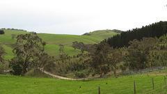
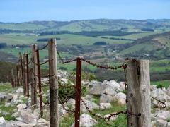
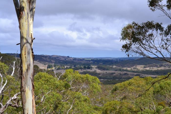
The park conserves 90 ha of remnant land that was left virtually untouched by the early landholders because of its steep terrain and rocky outcrops. The summit of Mount Magnificent dominates the area, rising 380 metres above sea level.
Statement of Significance:
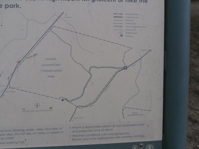
The stringybark association which occupies the lower elevations of the park contains a great variety of sclerophyllous shrubs including the two species of BANKSIA which occur in South Australia. Mount Magnificent is a prominent landmark in the district and at present it is the southern limit of the Heysen Trail which on completion will extend from the bottom of Fleurieu Peninsula to the northern Flinders Ranges (walking trail).
Description:
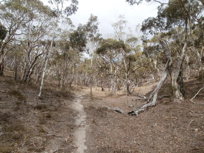
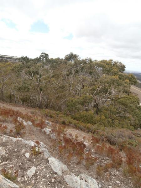
Mount Magnificent Conservation Park comprises the north-western slopes of Mount Magnificent which rises to 380m above sea level. The relatively flat land along the western boundary of the park carries stringybark low open forest (EUCALYPTUS BAXTERI, E OBLIQUA). With increasing gradient in an easterly direction, trees of E FASCICULOSA, E LEUCOXYLON and E HUBERANA form a woodland formation with a grassy understorey. Walking tracks provide access for visitors to the Park.
Condition and Integrity:
The Park is relatively unmodified.
www.parks.sa.gov.au/publish/groups/public/@parks/@northernlofty/documents/all/yurre_pdfs_mount_magnificent_c.pdf
The park conserves 90 ha of remnant land that was left virtually untouched by the early landholders because of its steep terrain and rocky outcrops. The summit of Mount Magnificent dominates the area, rising 380 metres above sea level.
Statement of Significance:
The stringybark association which occupies the lower elevations of the park contains a great variety of sclerophyllous shrubs including the two species of BANKSIA which occur in South Australia. Mount Magnificent is a prominent landmark in the district and at present it is the southern limit of the Heysen Trail which on completion will extend from the bottom of Fleurieu Peninsula to the northern Flinders Ranges (walking trail).
Description:
Mount Magnificent Conservation Park comprises the north-western slopes of Mount Magnificent which rises to 380m above sea level. The relatively flat land along the western boundary of the park carries stringybark low open forest (EUCALYPTUS BAXTERI, E OBLIQUA). With increasing gradient in an easterly direction, trees of E FASCICULOSA, E LEUCOXYLON and E HUBERANA form a woodland formation with a grassy understorey. Walking tracks provide access for visitors to the Park.
Condition and Integrity:
The Park is relatively unmodified.
www.parks.sa.gov.au/publish/groups/public/@parks/@northernlofty/documents/all/yurre_pdfs_mount_magnificent_c.pdf
Nearby cities:
Coordinates: 35°18'27"S 138°40'46"E
- Greater Melbourne 565 km
- Wagga Wagga NSW 770 km
- Shoalhaven 1032 km
- Greater Sydney, NSW 1077 km
- Western Sydney 1077 km
- Blue Mountains 1077 km
- Sydney 1115 km
- WESTERN SYDNEY 1115 km
- City of Brisbane, QLD 1601 km
- Auckland, NZ 3217 km
- Kyeema Conservation Park 4.7 km
- Cox Scrub Conservation Park 5.3 km
- Kuitpo Forest Reserve 9 km
- Scott Conservation Park 13 km
- Kuitpo Forest Reserve 15 km
- City of Onkaparinga 16 km
- Blewitt Springs 17 km
- Spring Mount Conservation Park 20 km
- Macclesfield 20 km
- Onkaparinga River National Park 20 km
Comments