Kediet ej Jill
| mountain
Mauritania /
Tiris Zammur /
Zuwarat /
World
/ Mauritania
/ Tiris Zammur
/ Zuwarat
, 12 km from center (ازويرات)
World / Mauritania / Tiris Zemmour
mountain
Add category

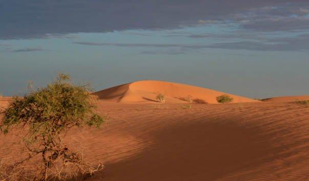
Kediet ej Jill (Arabic: كدية الجل) is a mountain in Tiris Zemmour, Mauritania, with the city of Zouérat on its east and Fderick at west. At 915 m tall, Kediet ej Jill includes the highest peak in Mauritania.
The mountain and its surrounding area are rich in iron deposits, thought to have been mined here since the 11th century and commercially exploited since 1952. The current mines are connected to Nouadhibou on the Atlantic coast by a 700-km long railway.
The mountain appears bluish because of the high concentration of magnetite, an iron ore and a natural magnet. Owing to its inherent magnetic properties, the mountain disrupts navigational compasses. Similar magnetic fields allowed the discovery of other deposits in the region (magnetite guelbs) in the 1960s.
Wikipedia article: http://en.wikipedia.org/wiki/Kediet_ej_Jill
Nearby cities:
Coordinates: 22°39'44"N 12°34'18"W
- Iniyan 232 km
- Adrar Sutuf 334 km
- Aguerguer / Acsecsu 335 km
- Aguerguer El Areg 371 km
- Aguerguer 377 km
- Arrabtt Hamma 386 km
- Jbilat Khreibichat 539 km
- Teide National Park 758 km
- Tenerife 791 km
- Savage Islands 905 km
- Sebkra d' Idjill 36 km
- El Hammam 70 km
- El Hachya 80 km
- Tirss/ Tiris 160 km
- Tarf Semamit 175 km
- Sebkhat Aghzoumal 184 km
- Sebkha Oumm El Drous Gouébli 185 km
- Gor Lefcah 192 km
- Sebkha Oumm El Drous Telli 211 km
- Uad Zbayra 242 km