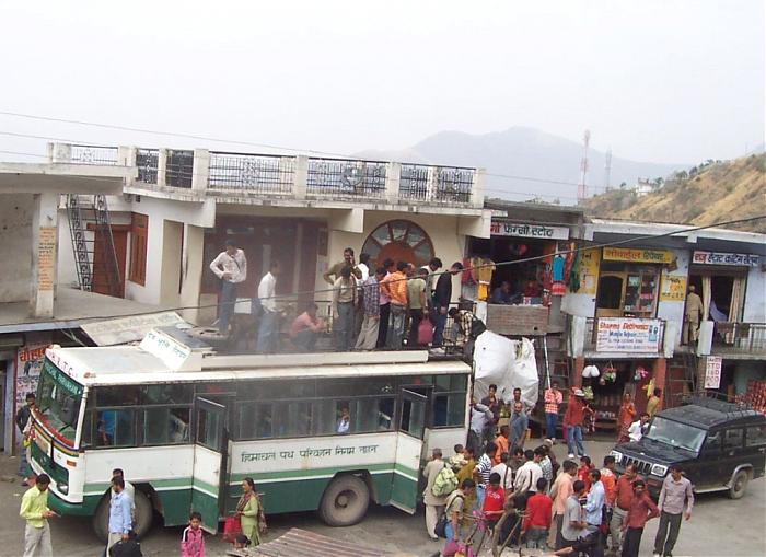
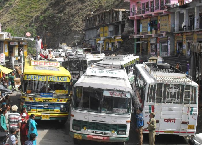
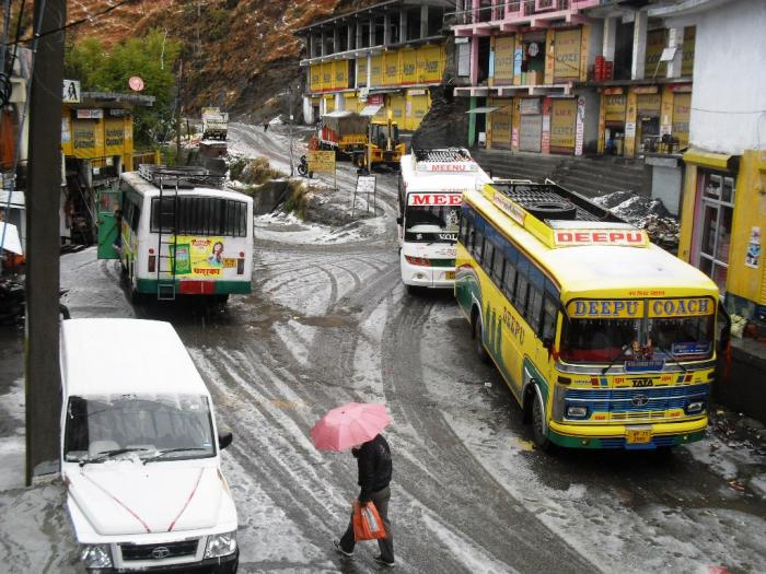
Bus Stand Sangrah (Sangrah)
India /
Himachal Pradesh /
Nahan /
Sangrah
World
/ India
/ Himachal Pradesh
/ Nahan
World / India / Himachal Pradesh / Sirmaur
bus stand
Add category
Bus Stand Sangrah Town, District Sirmaur, Himachal Pradesh, Pin-173023, India.
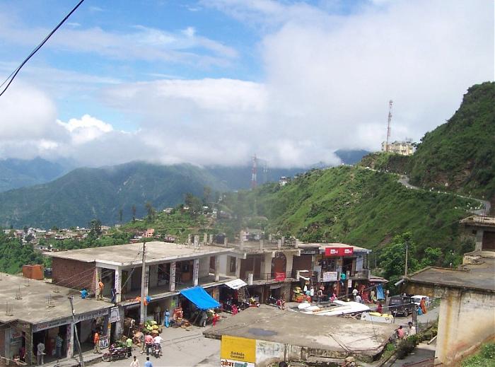
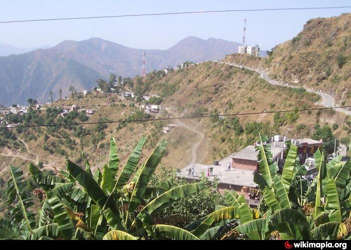
Sangrah is a Beautiful Town, Green Valley and Sub-Division of District Sirmour, Himachal Pradesh. Sangrah Town is about 358 K.M. from Delhi, 161 K.M. from Shimla, 152 K.M. from Chandigarh, 65 K.M. from Rajgarh, 63 K.M. from Nahan and 25 K.M. from Renuka Ji (By Road). Government Degree College Sangrah, SDM Office,Tehsil Office, BDO, HDO, ADO, BSNL Exchange, Police Station, Old House of National Awarded Kinkri Devi, Jawga Hils, Jawga Helipad, Rawlagarh Fort, Brah Forest, Bhagwan Parshuram Music School, Lord Vijat and Shiva Temple are the main attraction/Place of Sangrah. There are 41 Gram Panchayats in Sangrah Development Block and Sub-Division and total Road length of area is about 641 K.M. About 21 Panchayats of Sangrah Block has been covered with the Snow during winter season. Churdhar Hills, Jablog, Piulilani, Haripurdhar, Gattadhar, Balayandhar, Sunderdhat, Brah-Rupee, Jawga Hills, Choras and Diwri-Khrahan are the Snow bounded Area/ Hills/ Panoramic Valley/ Village/ Forest of Sangrah Block in winters. Population of Sangrah Sub-Division is about 70,500 and height of Sangrah Town is about 6,000 Feet. Budechhu, Dhakuli, Nati, Geeh, Thoda Fight and Purua are the Famous Folk Dance of this area. The main crops/cash crops of Sangrah Subdivision (c) are Maize, Wheat, Gram, Palsies, Tomato, Potato, Ginger, Pees and Garlic. Fruits Apple, Banana, Mango, Dry Fruits and Peach are grown over here.
Sangrah is a Beautiful Town, Green Valley and Sub-Division of District Sirmour, Himachal Pradesh. Sangrah Town is about 358 K.M. from Delhi, 161 K.M. from Shimla, 152 K.M. from Chandigarh, 65 K.M. from Rajgarh, 63 K.M. from Nahan and 25 K.M. from Renuka Ji (By Road). Government Degree College Sangrah, SDM Office,Tehsil Office, BDO, HDO, ADO, BSNL Exchange, Police Station, Old House of National Awarded Kinkri Devi, Jawga Hils, Jawga Helipad, Rawlagarh Fort, Brah Forest, Bhagwan Parshuram Music School, Lord Vijat and Shiva Temple are the main attraction/Place of Sangrah. There are 41 Gram Panchayats in Sangrah Development Block and Sub-Division and total Road length of area is about 641 K.M. About 21 Panchayats of Sangrah Block has been covered with the Snow during winter season. Churdhar Hills, Jablog, Piulilani, Haripurdhar, Gattadhar, Balayandhar, Sunderdhat, Brah-Rupee, Jawga Hills, Choras and Diwri-Khrahan are the Snow bounded Area/ Hills/ Panoramic Valley/ Village/ Forest of Sangrah Block in winters. Population of Sangrah Sub-Division is about 70,500 and height of Sangrah Town is about 6,000 Feet. Budechhu, Dhakuli, Nati, Geeh, Thoda Fight and Purua are the Famous Folk Dance of this area. The main crops/cash crops of Sangrah Subdivision (c) are Maize, Wheat, Gram, Palsies, Tomato, Potato, Ginger, Pees and Garlic. Fruits Apple, Banana, Mango, Dry Fruits and Peach are grown over here.
Nearby cities:
Coordinates: 30°41'39"N 77°25'35"E
- Bharog-Baneri 16 km
- Chandigarh Transport Undertaking Depot 2 59 km
- Kincraig 68 km
- Transport Nagar 90 km
- Dudhan sadhan 105 km
- Patiala Bus Stand 106 km
- Paharipur 115 km
- Adda Sran 123 km
- Kheri Jattan 143 km
- saneh gaon 152 km
- Brahawtar Forest 1.4 km
- Sharma Village Chilga 5.5 km
- SARWA HILLS 6.5 km
- Bharayan Chaman Village 6.7 km
- THEER DHAR 7.4 km
- BHAJAI DHAR AREA 8.2 km
- CHARNA 10 km
- Tape Ka Tila, Dadhahu, Renuka ji 10 km
- Osho Farms,Village Chaingan 10 km
- Renuka Lake 10 km