Frog Island (Leicester)
United Kingdom /
England /
Leicester
World
/ United Kingdom
/ England
/ Leicester
island, region
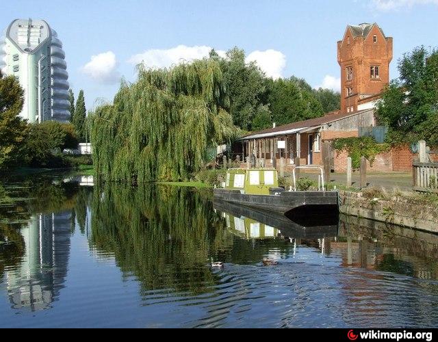
Frog Island is an inner city area of Leicester, England, so named because it lies between the River Soar and the Soar Navigation (a continuation of the Grand Union Canal). Frog Island is adjacent to the Woodgate area to the north, and Northgates to the South.
CC-BY-SA
(This article uses material from the Wikipedia article "Frog Island, Leicester", which is released under the creativecommons.org/licenses/by-sa/3.0/ )
CC-BY-SA
(This article uses material from the Wikipedia article "Frog Island, Leicester", which is released under the creativecommons.org/licenses/by-sa/3.0/ )
Wikipedia article: http://en.wikipedia.org/wiki/Frog_Island,_Leicester
Nearby cities:
Coordinates: 52°38'49"N 1°8'12"W
- Leicester Forest East 8.2 km
- Goldthorpe 100 km
- Newland with Wood House Moor 120 km
- RSPB Fairburn Ings 123 km
- Platt Bridge 139 km
- Wigan flashes nature reserve 141 km
- Greater South Craven urban area 152 km
- Wirral Peninsula 164 km
- East Middlesbrough and Eston & Southbank 216 km
- Ards Penninsula (Aird Uladh) 376 km
- Abbey Park 0.2 km
- St Matthews 1.1 km
- Cobden Industrial Estate 1.6 km
- Birstall Golf Club & Ground 2.7 km
- Watermead Country Park South 2.9 km
- Humberstone Heights Golf Club 3.7 km
- Watermead Country Park 4.1 km
- Manor Farm 4.1 km
- The Cedars Academy 4.6 km
- Watermead Country Park North 5 km