Atta Abad Lake
Pakistan /
Northern Areas /
Hunza /
World
/ Pakistan
/ Northern Areas
/ Hunza
World / Pakistan / Northern Areas / Northern Areas
lake
Add category

Attaabad Lake, also known as Hunza Lake, is a lake in the Hunza Valley of northern Pakistan created in January 2010 by a landslide dam.
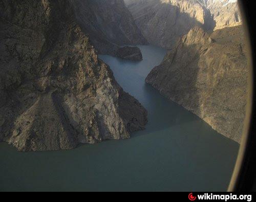
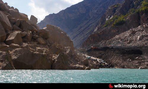
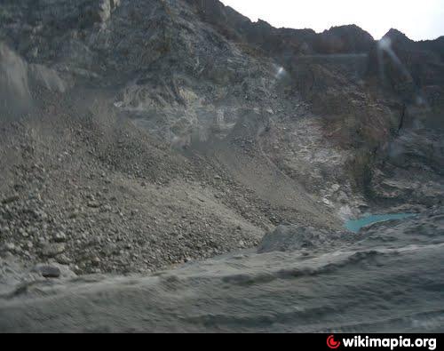
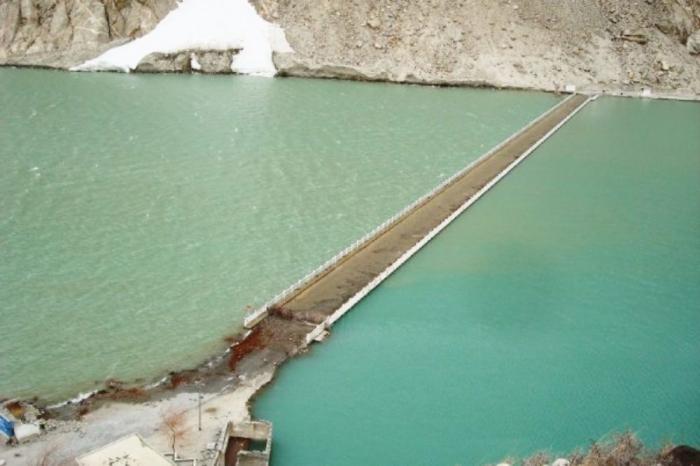
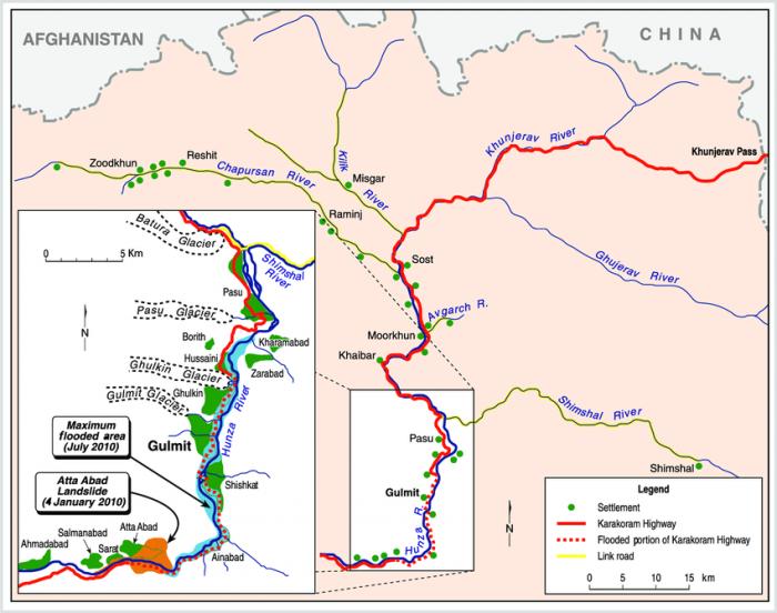
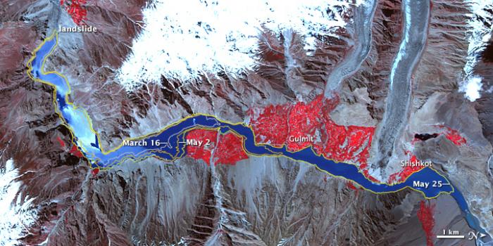
The lake was formed due to a massive landslide at Attaabad village in Gilgit-Baltistan, 9 miles (14 km) upstream (east) of Karimabad that occurred on January 4, 2010.The landslide killed twenty people and blocked the flow of the Hunza River for five months. The lake flooding has displaced 6,000 people from upstream villages, stranded (from land transportation routes) a further 25,000,and inundated over 12 miles (19 km) of the Karakoram Highway.The lake reached 13 miles (21 km) long and over 100 metres in depth by the first week of June 2010 when it began flowing over the landslide dam, completely submerging lower Shishkat and partly flooding Gulmit.The subdivision of Gojal has the greatest number of flooded buildings, over 170 houses and 120 shops. The residents also had shortages of food and other items due to the blockage of the Karakoram Highway.
Landslide was caught on camera
www.youtube.com/watch?v=zevBVop-sCk
The link below has a pictorial history of Attaabad lake.
www.siasat.pk/forum/showthread.php?38226-Landslide-lake...
Wikipedia article: http://en.wikipedia.org/wiki/Attabad_Lake
Nearby cities:
Coordinates: 36°19'52"N 74°50'32"E
- Snow Lake 63 km
- Maja Sar Lake 112 km
- Satpara Lake 140 km
- Shaghichi An Lake 146 km
- Shausar Lake 153 km
- Chittakatha Sar 159 km
- Lulusar 161 km
- Gangbal Lake 211 km
- Wular Lake 215 km
- Salnai Valley Lakes 223 km
- Ghulkin (or Hussaini) Glacier 11 km
- Karimabad (Baltit) 16 km
- Ganish Hunza 17 km
- Janabad Passu 18 km
- Passu Glacier 19 km
- Nagar-1 20 km
- Tupopdan mountain ridge (Passu Cones) 25 km
- Nasirabad 31 km
- Batura Glacier 32 km
- Nagar 2 40 km