Puilaurens Castle
France /
Languedoc-Roussillon /
Puilaurens /
World
/ France
/ Languedoc-Roussillon
/ Puilaurens
France / World / Languedoc-Roussillon / Aude / Limoux / Axat
castle, ruins, listed building / architectural heritage
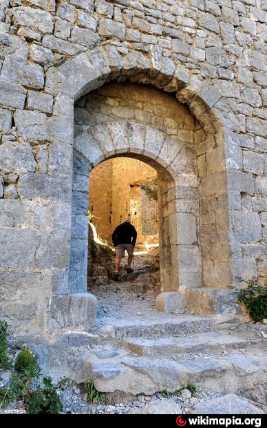
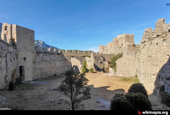
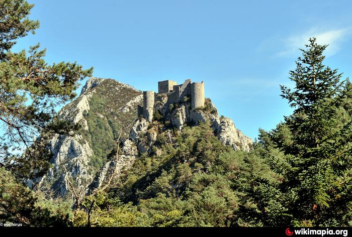
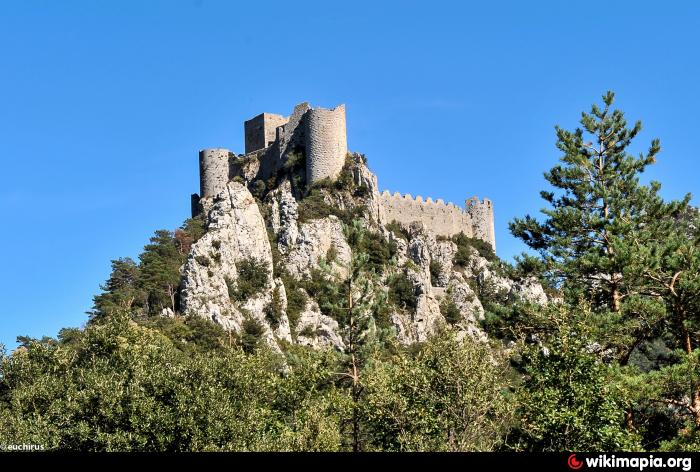
On the limit between the counties of Aude and Pyrenees-Orientales, Puilaurens was for a long time the southern-most fortified castle in the kingdom of France. At 700 metres altitude, the castle overlooks the village of Lapradelle, surrounded by a fir forest. The first mention of the castle of Puilaurens dates from 985 A.D. At that time the castle depended on the abbey of Saint-Michel-de-Cuxa. During the 11th century, it was under the sovereignty of the count of Besalù, then of the viscount of Narbonne. www.payscathare.org/3-6574-History.php
The castle has been listed as a monument historique by the French Ministry of Culture since 1902.
The castle has been listed as a monument historique by the French Ministry of Culture since 1902.
Wikipedia article: http://en.wikipedia.org/wiki/Puilaurens_Castle
Nearby cities:
Coordinates: 42°48'14"N 2°17'58"E
- Castle of Peyrepertuse 22 km
- Puivert castle - Chateau de Puivert 24 km
- Château de Lagarde 41 km
- Castell de Rocabruna 53 km
- Château de Foix 60 km
- Cardona's Castle 111 km
- Comte de Valltordera Medieval Castle 128 km
- Castle Walls 191 km
- Mequinenza 229 km
- Miravet castle 242 km
- Electrical substation 8 km
- Electrical substation 17 km
- Peak Madres 19 km
- Church of St. Vincent 22 km
- Prades - Molitg-les-Bains Train Station 23 km
- Fort Libèria 24 km
- SNCF Train Station, Villefranche-de-Conflent 24 km
- Electrical substation 27 km
- Electrical substation 28 km
- Lac de Matemale 31 km