Daategad
| hillfort
India /
Maharashtra /
Patan /
World
/ India
/ Maharashtra
/ Patan
World / India / Maharashtra / Satara
hillfort
Add category

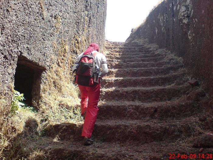
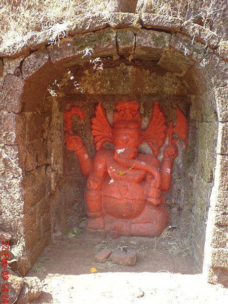


The construction is very interesting as most of fortification is deep stone carved. The main cave is very deep and step route is made to reach there. This cave must have total 2 or 3 chambers but it totally filled with mud and water need of exploration. Similar deep steps and well like cave found on Kamalgad also near Vaai. There is one small cave put Shiva Lingam idol. The main entrance is at west side of this slim and comparatively thin and small fort. We found 7 feet high Ganesh and Hanuman sculptures made at the inside walls of main entrance. Most of the walls are demolished by wind and rain as there is no one looks after this poor fort. There is now easy access from Paatan town place at the base with the high rising road via Tolewadi. Dategad is also known as Sundargad.
Nearby cities:
Coordinates: 17°22'44"N 73°51'51"E
- Rawala and Jawala forts Plateau 334 km
- Kille Dhodap 336 km
- Kille Ahivant 339 km
- Kille Mulher & Mora 378 km
- Mandu Fort 577 km
- Asirgarh 705 km
- Polonnaruwa Archaeological Complex 1301 km
- Gyaur Kala fortress (Seleucid-Sassanid era) 2531 km
- Sultan Kala Fortress (Abbasid/Seljuk era) 2533 km
- Tape Zaghe & Tape Ghabrestan & Ghare Tape- 7000 BC 3129 km
- Mountain Park, A Brand New Hill Station for you ! 1.3 km
- shivtej cricket club pimploshi 1.6 km
- venus leisure (India) Ltd, 1.6 km
- pimploshi villege 1.6 km
- Hill near Dategad 1.7 km
- JOTIBACHI WADI YERAD Created by KRISHNAT ANANDA KAMBLE (yarad) 2.1 km
- kiranpawar land mumbai 3 km
- miraswadi(shiral) 3.1 km
- dev kada (shiral,taichiwadi) 3.3 km
- Patan Taluka 3.5 km
Comments