Santurce (San Juan)
| neighborhood
Puerto Rico /
San Juan /
San Juan
World
/ Puerto Rico
/ San Juan
/ San Juan
World / Puerto Rico
neighborhood, invisible
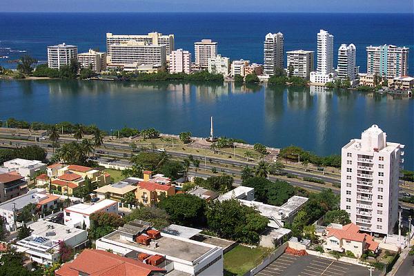
Santurce is a district in San Juan, Puerto Rico. The name Santurce comes from St. George. The original Santurce is a town near Bilbao, in Spain (in Basque Santurtzi). With a 2000 population of 94,067 living in a land area of 5.24 square miles (13.57 km²), it is the most populous "barrio" in Puerto Rico and one of the most densely populated areas of San Juan at 17,951.7 residents per square mile (6,931.2/km²).
Santurce is bounded by the Atlantic Ocean in the north, with more than five km of beaches from the Condado peninsula in the west, to a point 600 m east of "Punta Las Marías", where it borders on Isla Verde district of Carolina, and "Laguna San José" and its northern embayment, "Laguna Los Corozos" to the east.
To the south by "Caño de Martín Peña", and the northern barrios of former municipio Río Piedras (Hato Rey Norte, Hato Rey Central, Oriente), and to the west with the "Bahia of San Juan", where three bridges, "Puente Dos Hermanos" (Ave. Ashford), "Puente G. Esteves" (Ave. Ponce de León) and "Puente San Antonio" (Ave. Fernandes Juncos) connect Santurce with "La Isleta" (small island) where Old San Juan is located. It has a total area of 8.70 square miles (22.53 km²) composed of 5.24 square miles (13.57 km²) of land and 3.46 square miles (8.96 km²) of water area.
The topography is mainly flat with low hills toward the central areas and swampy areas to the south along Caño Martín Peña and to the east near the Laguna San José (San Jose Lagoon). To the west side, most of the land that nowadays is called Isla Grande was part of land reclamation, made possible by filling in marshes.
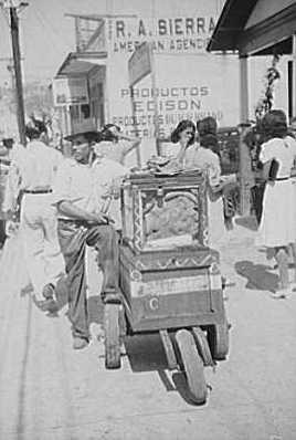
Originally settled by the native Tainos, the area later became home to a significant population of slaves of African ancestry who arrived from the neighboring Danish Virgin Islands. Due to the abundance of crabs found in the area, the district became commonly known as "Cangrejos" (the Spanish word for crabs). Throughout the centuries, the district continued to grow due to its location at the crossroads between San Juan and its southern suburbs. A group or residents led by Pedro Cortijo were granted permission to establish a Roman Catholic church, consecrated to Saint Matthew, and established the settlement (town) of "San Mateo de Cangrejos" on November 20, 1773.
In 1876, Pablo Ubarri, an engineer from the Basque Country region of Spain arrived on the island to help in the construction of a railroad system and a steam tramway between San Juan and the town of Río Piedras through the center of "Cangrejos" which prompted the gentrification of the district. Many years after his arrival he was granted the title of Count of Santurce by the Spanish Crown. With his newly acquired title and influence, the district was renamed after his title (a decision that has caused controversy ever since). The neighboring Condado also received its present-name from Ubarri's title, as the district's name literally translates to "county" (which in medieval tradition is land granted by a monarch to a count).[1]
During most of the 1930s and up to the 1950s, Santurce along with neighboring district Miramar becomes one of the most vibrant areas of the capital. However, by the 1970s, most of the district had fallen into decay and it hasn’t been able to recapture the luster and vibrancy it once had.
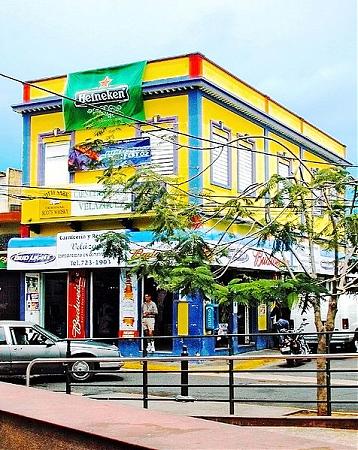
Today, the district is starting to see a resurgence in importance and life as many business and local establishments such as bars, clubs, and restaurants have opened their doors to locals and tourists alike due to the importance of trade and tourism in San Juan.
Santurce is subdivided into 40 "sub-barrios" or "sectors". There is an unassigned area (23 on the map) located west of "Merhoff", north of "Las Palmas", east of "Herrera", and south of "Shanghai". Census documents say that the unassigned portion of San Juan Municipio, Santurce barrio should be attributed to Merhoff subbarrio.
The most densely populated area lies to the Southeast bordering the "Laguna de San Jose" and the "Caño de Martín Peña", while the less densely populated areas are found by the mangrove swamps to the South surrounding the "Caño de Martín Peña", and the West part of Santurce called Isla Grande, in what used to be a military base of the United States Navy.
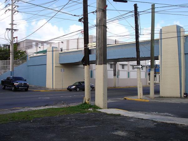
Santurce is served by a metro system called "Tren Urbano" (Urban Train), with the Sagrado Corazón station located on the central-south-east section of the district, an area known as "Parada 27" (Stop 27), which evokes the names of the old trolley stops. Various bus lines (guaguas) operated by the Metropolitan Bus Authority (Autoridad Metropolitana de Autobuses or AMA in Spanish) provide service in the area as well.
Santurce is bounded by the Atlantic Ocean in the north, with more than five km of beaches from the Condado peninsula in the west, to a point 600 m east of "Punta Las Marías", where it borders on Isla Verde district of Carolina, and "Laguna San José" and its northern embayment, "Laguna Los Corozos" to the east.
To the south by "Caño de Martín Peña", and the northern barrios of former municipio Río Piedras (Hato Rey Norte, Hato Rey Central, Oriente), and to the west with the "Bahia of San Juan", where three bridges, "Puente Dos Hermanos" (Ave. Ashford), "Puente G. Esteves" (Ave. Ponce de León) and "Puente San Antonio" (Ave. Fernandes Juncos) connect Santurce with "La Isleta" (small island) where Old San Juan is located. It has a total area of 8.70 square miles (22.53 km²) composed of 5.24 square miles (13.57 km²) of land and 3.46 square miles (8.96 km²) of water area.
The topography is mainly flat with low hills toward the central areas and swampy areas to the south along Caño Martín Peña and to the east near the Laguna San José (San Jose Lagoon). To the west side, most of the land that nowadays is called Isla Grande was part of land reclamation, made possible by filling in marshes.
Originally settled by the native Tainos, the area later became home to a significant population of slaves of African ancestry who arrived from the neighboring Danish Virgin Islands. Due to the abundance of crabs found in the area, the district became commonly known as "Cangrejos" (the Spanish word for crabs). Throughout the centuries, the district continued to grow due to its location at the crossroads between San Juan and its southern suburbs. A group or residents led by Pedro Cortijo were granted permission to establish a Roman Catholic church, consecrated to Saint Matthew, and established the settlement (town) of "San Mateo de Cangrejos" on November 20, 1773.
In 1876, Pablo Ubarri, an engineer from the Basque Country region of Spain arrived on the island to help in the construction of a railroad system and a steam tramway between San Juan and the town of Río Piedras through the center of "Cangrejos" which prompted the gentrification of the district. Many years after his arrival he was granted the title of Count of Santurce by the Spanish Crown. With his newly acquired title and influence, the district was renamed after his title (a decision that has caused controversy ever since). The neighboring Condado also received its present-name from Ubarri's title, as the district's name literally translates to "county" (which in medieval tradition is land granted by a monarch to a count).[1]
During most of the 1930s and up to the 1950s, Santurce along with neighboring district Miramar becomes one of the most vibrant areas of the capital. However, by the 1970s, most of the district had fallen into decay and it hasn’t been able to recapture the luster and vibrancy it once had.
Today, the district is starting to see a resurgence in importance and life as many business and local establishments such as bars, clubs, and restaurants have opened their doors to locals and tourists alike due to the importance of trade and tourism in San Juan.
Santurce is subdivided into 40 "sub-barrios" or "sectors". There is an unassigned area (23 on the map) located west of "Merhoff", north of "Las Palmas", east of "Herrera", and south of "Shanghai". Census documents say that the unassigned portion of San Juan Municipio, Santurce barrio should be attributed to Merhoff subbarrio.
The most densely populated area lies to the Southeast bordering the "Laguna de San Jose" and the "Caño de Martín Peña", while the less densely populated areas are found by the mangrove swamps to the South surrounding the "Caño de Martín Peña", and the West part of Santurce called Isla Grande, in what used to be a military base of the United States Navy.
Santurce is served by a metro system called "Tren Urbano" (Urban Train), with the Sagrado Corazón station located on the central-south-east section of the district, an area known as "Parada 27" (Stop 27), which evokes the names of the old trolley stops. Various bus lines (guaguas) operated by the Metropolitan Bus Authority (Autoridad Metropolitana de Autobuses or AMA in Spanish) provide service in the area as well.
Wikipedia article: http://en.wikipedia.org/wiki/Santurce,_Puerto_Rico
Nearby cities:
Coordinates: 18°26'41"N 66°4'13"W
- Guayabota neighborhood 39 km
- Calabazas neighborhood 42 km
- Pueblo neighborhood 42 km
- Juan Martín neighborhood 46 km
- Puerto Real neighborhood 69 km
- Puerto Diablo 73 km
- Puerto Ferro neighborhood 74 km
- Flamenco neighborhood 77 km
- San Isidro neighborhood 83 km
- Fraile neighborhood 84 km
- Figueroa 0.6 km
- Buenos Aires 1 km
- SagradoCorazón 1.2 km
- Condado 1.4 km
- El Parque 1.5 km
- Loíza 1.9 km
- Barrio Obrero 2.2 km
- Ocean Park 2.3 km
- Las Palmas 2.6 km
- San Juan Maritime Zone 3.7 km