South Street Landing (Providence, Rhode Island)
USA /
Rhode Island /
Providence /
Providence, Rhode Island /
Eddy Street, 350
World
/ USA
/ Rhode Island
/ Providence
World / United States / Rhode Island
university, NRHP - National Register of Historic Places, Classicism, interesting place
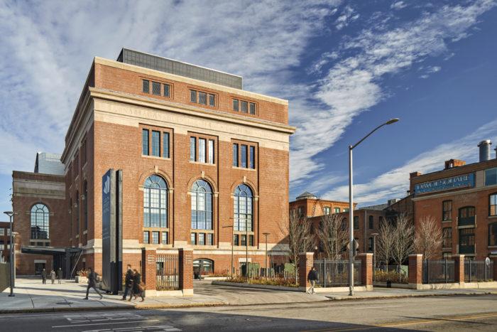
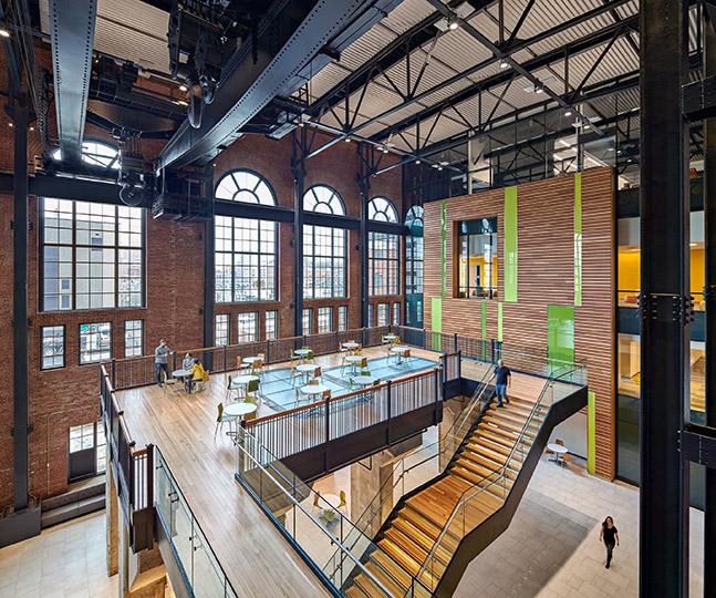
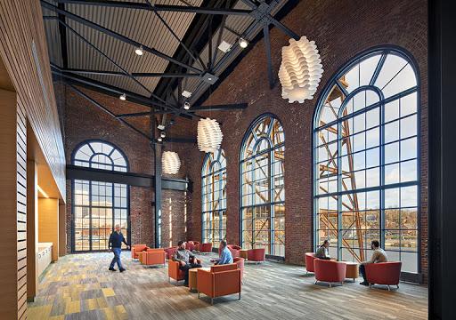
Formerly a Narragansett Electric Company power plant designed c. 1912 by Jenks & Ballou. It is now adaptively reused as an academic center shared by Brown University, Rhode Island College, and University of Rhode Island.
www.brown.edu/a-z/south-street-landing
tsoikobus.design/project_cv_ssl.html
www.youtube.com/watch?v=G2kDb24CFog&feature=emb_tit...
www.brown.edu/a-z/south-street-landing
tsoikobus.design/project_cv_ssl.html
www.youtube.com/watch?v=G2kDb24CFog&feature=emb_tit...
Wikipedia article: http://en.wikipedia.org/wiki/South_Street_Station
Nearby cities:
Coordinates: 41°49'6"N 71°24'21"W
- Rocky Point Amusment Park (Abandoned) 14 km
- The home of the "Quonset hut" 23 km
- Escobar's Highland Farm 28 km
- The Head of Westport 36 km
- Ocean Sprays Cranberry Bogs 37 km
- Hammersmith Farm 39 km
- Beacon Hill Estate 40 km
- Padanaram 46 km
- Chilmark 68 km
- Block Island, Rhode Island 68 km
- Downtown Providence 0.7 km
- Upper South Providence 0.9 km
- College Hill 1.3 km
- Lower South Providence 1.9 km
- Elmwood 2.3 km
- Watchemoket 2.4 km
- Mount Hope 3 km
- Blackstone 3.2 km
- Kent Heights 4 km
- Rumford 5.1 km