Liberty City (Miami, Florida)
| neighborhood
USA /
Florida /
Brownsville /
Miami, Florida
World
/ USA
/ Florida
/ Brownsville
World / United States / Florida
neighborhood, draw only border
Miami's poorest and most dangerous neighborhood.
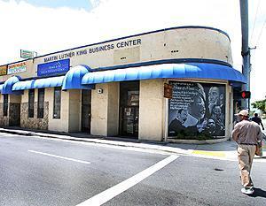
Liberty City is a neighborhood in North Miami, Florida, within Miami's city limits.
The area comprises more than half of Miami-Dade County's nearly half a million African Americans (as of 2000 Census). Liberty City's boundaries are roughly as follows: Northwest 79th Street to the north, Northwest 27th Avenue to the west, Northwest 41st Street to the south, and Interstate 95 to the east.
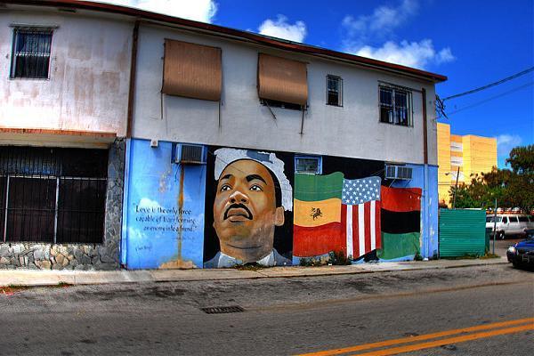
Liberty City is named for the Liberty Square Housing Project (Pork-n-Beans) built in the late 1930s for Miami's low-income African-Americans, the second of its kind in the South at the time.
Liberty City is home to Miami Northwestern High School which has had a student population of more than 2250 students the past four years with more than 90% African-American and 6% Hispanic. Liberty City also produced the Miami Heat's Udonis Haslem and professional wrestler Alvin Burke, Jr. (better known by his stage name MVP). Darlyne Chauve's art studio and gallery is in Liberty City. Liberty City has produced many of Miami's rap stars.
Liberty City is a neighborhood in North Miami, Florida, within Miami's city limits.
The area comprises more than half of Miami-Dade County's nearly half a million African Americans (as of 2000 Census). Liberty City's boundaries are roughly as follows: Northwest 79th Street to the north, Northwest 27th Avenue to the west, Northwest 41st Street to the south, and Interstate 95 to the east.
Liberty City is named for the Liberty Square Housing Project (Pork-n-Beans) built in the late 1930s for Miami's low-income African-Americans, the second of its kind in the South at the time.
Liberty City is home to Miami Northwestern High School which has had a student population of more than 2250 students the past four years with more than 90% African-American and 6% Hispanic. Liberty City also produced the Miami Heat's Udonis Haslem and professional wrestler Alvin Burke, Jr. (better known by his stage name MVP). Darlyne Chauve's art studio and gallery is in Liberty City. Liberty City has produced many of Miami's rap stars.
Wikipedia article: http://en.wikipedia.org/wiki/Liberty_City,_Florida
Nearby cities:
Coordinates: 25°49'33"N 80°13'3"W
- Virginia Key 8.5 km
- Coconut Grove 10 km
- Flagami 11 km
- University Park 18 km
- Country Estates 34 km
- Weston Hills 38 km
- Jupiter Farms 126 km
- Montura Ranch Estates 131 km
- Pioneer Plantation 144 km
- Port La Belle, Florida 161 km
- Gladeview, Florida 2.1 km
- Buena Vista 2.2 km
- Lemon CIty (Little Haiti) 2.4 km
- Brownsville, Florida 2.4 km
- Little River 3.1 km
- West Little River, Florida 3.8 km
- Upper East Side 3.8 km
- Pinewood, Florida 4.8 km
- Westview, Florida 6.7 km
- Miami-Dade County, Florida 41 km
Comments