Fort Augustus
United Kingdom /
Scotland /
Fort Augustus /
World
/ United Kingdom
/ Scotland
/ Fort Augustus
World / United Kingdom / Scotland
town, draw only border


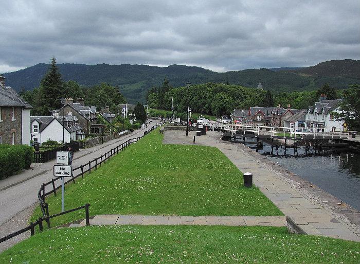
Fort Augustus (Ordnance Survey grid reference NH379090) is a settlement in the Scottish Highlands, at the south west end of Loch Ness. The village has a population of around 646 (2001). The village is heavily reliant on tourism.
The Gaelic name for the modern village is Cill Chuimein, and the accepted etymology is that the settlement was originally named after Saint Cummein of Iona who built a church there. Other suggestions are that it was originally called Ku Chuimein after one of two abbots of Iona of the Comyn clan, whose badge Lus mhic Chuimein refers to the Cumin plant, or that it was called Cill a' Chuimein ("Comyn's Burialplace") after the last Comyn in Lochaber.
In the aftermath of the Jacobite uprising in 1715, General Wade built a fort (taking from 1729 until 1742) which was named after the Duke Of Cumberland. The settlement grew, and eventually took the name of this fort. The fort was captured by the Jacobites in April 1745, just prior to the Battle of Culloden.
The actual fort was sold to the Lovat family in 1867 and in 1876 they passed the site and land onto the Benedictine order. The monks made an abbey from the fort and later constructed a school there, but abandoned the site in 1998. For several years after that it was owned by Terry Nutkins.
The village was served by a rail line to Spean Bridge from 1903 until 1933, built by the North British Railway, but initially operated by the Highland Railway. The Caledonian Canal connecting Fort William to Inverness passes through Fort Augustus in a dramatic series of locks stepping down to Loch Ness.
The village is served by the Cill Chuimein Medical Centre.
Wikipedia article: http://en.wikipedia.org/wiki/Fort_Augustus
Nearby cities:
Coordinates: 57°8'40"N 4°41'1"W
- Kinnaird 113 km
- Greenock 132 km
- Falkirk 135 km
- Cumbernauld 135 km
- Glenrothes 136 km
- Dunfermline 138 km
- Paisley 141 km
- Kirkcaldy 143 km
- Livingston 152 km
- Motherwell 154 km
- Caledonian Canal 2.4 km
- Millennium Wind Farm 10 km
- Loch Garry 17 km
- Loch Ness 18 km
- Loch Mhòr 19 km
- Loch Beinn a’ Mheadhoin 21 km
- The Parallel Roads of Glen Roy 21 km
- Loch Lochy 24 km
- Loch Laggan 25 km
- Perth and Kinross Council 83 km