Dumka
| town, taluka headquarter, district headquarter
India /
Jharkhand /
Dumka /
World
/ India
/ Jharkhand
/ Dumka
World / India / Jharkhand / Dumka
town, taluka headquarter, district headquarter

Anchal Dumka, District Dumka, Jharkhand.
Dumka is a Nagar Parishad city in district of Dumka, Jharkhand.
The Dumka Nagar Parishad has population of 47,584 as per report released by Census India 2011.
Dumka is located at 24°16′N 87°15′E / 24.27°N 87.25°E / 24.27; 87.25.[1] It has an average elevation of 137 metres (449 feet).
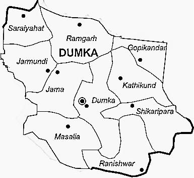
The Dumka district has an area of 3716.02 sq km and consists of only one sub division namely Dumka. Under the Dumka sub division, there are 10 blocks namely Dumka, Gopikander, Jama, Jarmundi, Kathikund, Maslia, Ramgarh, Raneshwar, Shikaripara and Saraiyahat.
Dumka is a city and a municipality in and headquarters of Dumka district in the state of Jharkhand, India.
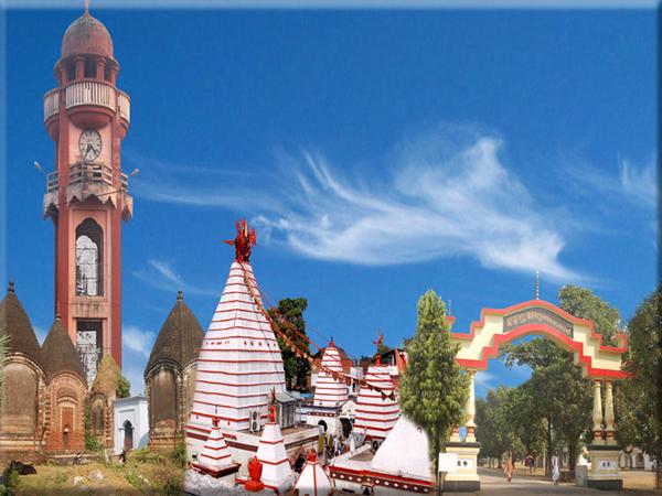
Dumka District have many popular temples like Basukinath, Sirshanath, Maluti Mandir, Shiv Pahar, Dharamsthana. A lots of crowd visit these place during the month of Sawan. Babadham is also the most popular temple but it is situated in Deoghar District near the Dumka District.
Dumka is a Nagar Parishad city in district of Dumka, Jharkhand.
The Dumka Nagar Parishad has population of 47,584 as per report released by Census India 2011.
Dumka is located at 24°16′N 87°15′E / 24.27°N 87.25°E / 24.27; 87.25.[1] It has an average elevation of 137 metres (449 feet).
The Dumka district has an area of 3716.02 sq km and consists of only one sub division namely Dumka. Under the Dumka sub division, there are 10 blocks namely Dumka, Gopikander, Jama, Jarmundi, Kathikund, Maslia, Ramgarh, Raneshwar, Shikaripara and Saraiyahat.
Dumka is a city and a municipality in and headquarters of Dumka district in the state of Jharkhand, India.
Dumka District have many popular temples like Basukinath, Sirshanath, Maluti Mandir, Shiv Pahar, Dharamsthana. A lots of crowd visit these place during the month of Sawan. Babadham is also the most popular temple but it is situated in Deoghar District near the Dumka District.
Wikipedia article: http://en.wikipedia.org/wiki/Dumka
Nearby cities:
Coordinates: 24°16'4"N 87°14'33"E
- Andal 71 km
- Panagarh 89 km
- Bahadurpur 169 km
- Kalyani 183 km
- Amta 200 km
- Domjur 202 km
- Barasat 208 km
- Jessore District Town 229 km
- Haldia 246 km
- Khulna 272 km
- RAJA'S HOME SWEET HOME 0.4 km
- Dudhani; Dumka; Jharkhand 1.2 km
- Rasikpur, Dumka 1.9 km
- Santal Pargana College 2.5 km
- Government Polytechnic 2.8 km
- Block Colony 3.2 km
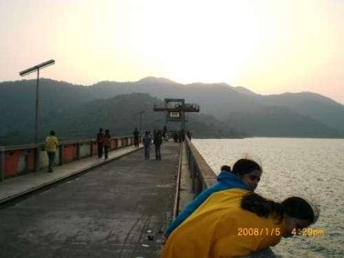
- Sidhu Kanhu Boating Park 4.2 km
- Sidhu Kanu Airstrip 4.9 km
- Chuto Pahaar 5.7 km
- Chigal Pahari 7 km
Comments