Jashore District Town
Bangladesh /
Jessor /
World
/ Bangladesh
/ Jessor
/ Jessor
World / Bangladesh / Khulna / Jessore / Jessore
city, town, third-level administrative division, town district
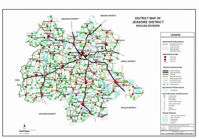
Jashore District (khulna division) with an area of 2578.20 sq km, is bounded by Jhenaidah and magura districts on the north, satkhira and khulna districts on the south, narail and Khulna districts on the east, West Bengal of India on the west. Annual average temperature: maximum 37.1°C, minimum 11.2°C; annual rain fall 1537 mm. Noted rivers are bhairab and Mukteshwari; beel 3.
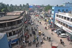
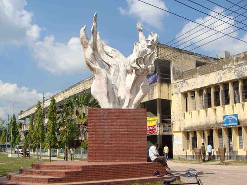
Jashore (Town) which stands on the Bhairab, consists of 9 wards and 73 mahalls. Jessore municipality was established in 1864. The area of the town is 25.72 sq km. The town has a population of 1,178,273; male 52.97%, female 47.03%. Literacy rate among the town people is 56.57%. The town has one dakbungalow. The District is famous for its Date-juice and handicrafts.
Administration: Jessore district was established in 1781. It consists of 4 municipalities, 36 wards, 8 upazilas, 92 unions, 1329 mouzas, 1434 villages and 120 mahallas. The upazilas are abhaynagar, bagherpara, chaugachha, jhikargachha, keshabpur, jessore sadar, manirampur and sharsha.
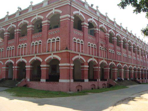
Archaeological heritage and relics: Remnants of the Chanchara Rajbari, Dargaha of Ghazi Kalu, Rajbari, Dighi and remnants of the palace of king Mukut Roy (12th century), residence of Nawab Mir Jumla (17th century), Imam Bari built by Haji Muhammad Muhsin at Murli.
Historical events: Jessore district belongs to the ancient Samatat Janapada. On the partition of India in 1947 Jessore was also partially divided. The entire district excepting Boangaon and Gaighata thanas was included into Bangladesh.
Population: 2440693; male 51.22%, female 48.78%; Muslim 86.5%; Hindu 13.21% and others 0.29%.
Religious institutions: Mosque 2936, temple 337, church 19, tomb 8, sacred place 4, most noted of which are Markas Mosque (Newmarket), Catholic Church, Marua Mandir and tomb of Hazrat Garib Shah.
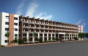
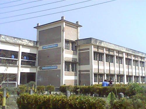
Literacy and educational institutions: Average literacy 33.4%; male 41% and female 25.1%. Educational institutions: college 44, high school 347, junior school 16, community school 13, madrasa 271, primary school 1018, polytechnic institute 1. Noted institutions: Michael Madusudhan University College, Government City College, Jessore Government Mohila College, Daud Public School.
Cultural organisations: Club 198, theatre group 24, theatre stage 5, cinema hall 19, public library 11, women's organisation 16, jatra party 6.
Locally published newspapers and periodicals Dainik Runner, Dainik Lok Samaj, Dainik Desh Hitoishi, Dainik Purabi, Dainik Kalyan (extinct), weekly Gramer Kagaj, weekly Kabatakkha (extinct).
Main occupations: Agriculture 39.84%, agricultural labourer 24.13%, wage labourer 2.68%, commerce 11.99%, service 8.66%, industry 1.41%, transport 3.11% and others 8.18%.
Main crops Paddy, jute, sugarcane, tuberose, vegetables..
Fisheries, dairies and poultries Poultry 1064, dairy 132, hatchery 39 and fishery 804.
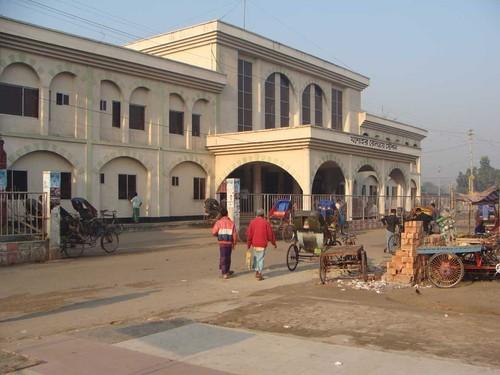
Communication facilities: Roads: pucca 455.48 km, semi pucca 163.82 km and mud road 3628.69 km; waterways 70 nautical mile; railways 48 km; airport 1.
Manufactories Textile mill, ball pen factory, comb & button factory, plastic factory, biscuit factory, ice factory, oil mill, rice mill etc.
Cottage industries Weaving, bamboo work, goldsmith, blacksmith, potteries, wood work, tailoring, etc.
Main exports Cotton, jute, leather, jackfruit, banana, comb and date molasses, vegetables.
NGO activities: Operationally important NGOs are brac, asa, grameen bank, proshika, Jagarani Chakra, Alo, Samaj Kalyan Sangstha, Bachte Shekha and Nijera Kari.
Health centres Hospital, 2, upazila health complex 8, union health and family planning centre 74, private clinic 11, satellite clinic 14.
Jashore (Town) which stands on the Bhairab, consists of 9 wards and 73 mahalls. Jessore municipality was established in 1864. The area of the town is 25.72 sq km. The town has a population of 1,178,273; male 52.97%, female 47.03%. Literacy rate among the town people is 56.57%. The town has one dakbungalow. The District is famous for its Date-juice and handicrafts.
Administration: Jessore district was established in 1781. It consists of 4 municipalities, 36 wards, 8 upazilas, 92 unions, 1329 mouzas, 1434 villages and 120 mahallas. The upazilas are abhaynagar, bagherpara, chaugachha, jhikargachha, keshabpur, jessore sadar, manirampur and sharsha.
Archaeological heritage and relics: Remnants of the Chanchara Rajbari, Dargaha of Ghazi Kalu, Rajbari, Dighi and remnants of the palace of king Mukut Roy (12th century), residence of Nawab Mir Jumla (17th century), Imam Bari built by Haji Muhammad Muhsin at Murli.
Historical events: Jessore district belongs to the ancient Samatat Janapada. On the partition of India in 1947 Jessore was also partially divided. The entire district excepting Boangaon and Gaighata thanas was included into Bangladesh.
Population: 2440693; male 51.22%, female 48.78%; Muslim 86.5%; Hindu 13.21% and others 0.29%.
Religious institutions: Mosque 2936, temple 337, church 19, tomb 8, sacred place 4, most noted of which are Markas Mosque (Newmarket), Catholic Church, Marua Mandir and tomb of Hazrat Garib Shah.
Literacy and educational institutions: Average literacy 33.4%; male 41% and female 25.1%. Educational institutions: college 44, high school 347, junior school 16, community school 13, madrasa 271, primary school 1018, polytechnic institute 1. Noted institutions: Michael Madusudhan University College, Government City College, Jessore Government Mohila College, Daud Public School.
Cultural organisations: Club 198, theatre group 24, theatre stage 5, cinema hall 19, public library 11, women's organisation 16, jatra party 6.
Locally published newspapers and periodicals Dainik Runner, Dainik Lok Samaj, Dainik Desh Hitoishi, Dainik Purabi, Dainik Kalyan (extinct), weekly Gramer Kagaj, weekly Kabatakkha (extinct).
Main occupations: Agriculture 39.84%, agricultural labourer 24.13%, wage labourer 2.68%, commerce 11.99%, service 8.66%, industry 1.41%, transport 3.11% and others 8.18%.
Main crops Paddy, jute, sugarcane, tuberose, vegetables..
Fisheries, dairies and poultries Poultry 1064, dairy 132, hatchery 39 and fishery 804.
Communication facilities: Roads: pucca 455.48 km, semi pucca 163.82 km and mud road 3628.69 km; waterways 70 nautical mile; railways 48 km; airport 1.
Manufactories Textile mill, ball pen factory, comb & button factory, plastic factory, biscuit factory, ice factory, oil mill, rice mill etc.
Cottage industries Weaving, bamboo work, goldsmith, blacksmith, potteries, wood work, tailoring, etc.
Main exports Cotton, jute, leather, jackfruit, banana, comb and date molasses, vegetables.
NGO activities: Operationally important NGOs are brac, asa, grameen bank, proshika, Jagarani Chakra, Alo, Samaj Kalyan Sangstha, Bachte Shekha and Nijera Kari.
Health centres Hospital, 2, upazila health complex 8, union health and family planning centre 74, private clinic 11, satellite clinic 14.
Wikipedia article: http://en.wikipedia.org/wiki/Jessore
Nearby cities:
Coordinates: 23°9'40"N 89°12'22"E
- Khulna 37 km
- Faridpur District Town 78 km
- Kalyani 84 km
- Barasat 90 km
- Bahadurpur 112 km
- Domjur 118 km
- Amta 138 km
- Haldia 169 km
- Panagarh 187 km
- Andal 217 km
- Jashore Cantonment 3.7 km
- Jashore Airport 5.4 km
- RUPDIA VILLAGE 6.1 km
- Rupdia Bazaar 9 km
- Bukbhara Baor/ Lake 9 km
- CHAMPAKONA 12 km
- Jhikargachha Upazila HQ 13 km
- তারুয়াপাড়া 13 km
- PROTAPKATI 13 km
- Khulna Division 32 km
Comments