Alavian Dam (Maragheh)
Iran /
Azarbayejan-e Sharqi /
Maragheh
World
/ Iran
/ Azarbayejan-e Sharqi
/ Maragheh
, 3 km from center (مراغه)
World / Iran / East Azarbaijan
dam
Add category

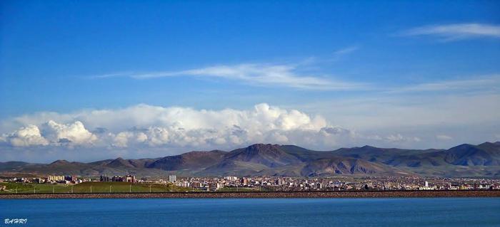
The Alavian Dam and Lake is situated on the Soofian Chay river in East Azerbaijan Province, northwestern Iran. It is located about 3 kilometres north of Maraqeh. It is an earth-fill embankment dam with a height of 76 metres and was built between 1990 and 1995; opening on January 1, 1996.[1] The dam serves to provide flood control and water supply for municipal and irrigation uses. After construction, it was noticed that the dam had settled five times more than expected. The settlement of the dam and its gallery, below the body, had unexpected differences as well. This led to "considerable" leakage in the gallery.
Wikipedia article: http://en.wikipedia.org/wiki/Alavian_Dam
Nearby cities:
Coordinates: 37°25'38"N 46°15'3"E
- Aydoghmush Lake Dam 114 km
- Azad Lake 224 km
- Daryan Dam Lake 244 km
- Manjil Dam Lake 275 km
- Gavoshan Lake 281 km
- Azadi Lake 320 km
- Taleghan Lake 414 km
- simareh dam 453 km
- Lar Dam Reservoir (Persian: درياچه سد لار) 531 km
- sad mamlo -- Mamlo Dam 531 km
- Alavian Dam Reservoir 1.9 km
- Walnut orchards, plums and apples, the northern city of Maragheh 2.8 km
- Valley of the Mordigh River (Dayti) 2.9 km
- Settlements Valieasr 2.9 km
- Settlements Golshar 5.4 km
- Sinjan Mount 7.2 km
- Gardens, ( orchards walnut, plum and apple) - the southern city of Maragheh 7.4 km
- Maragheh Plain 8 km
- gardens Grape vines south of Maragheh 10 km
- Valley of the Sofi Chay (Maragheh) River 18 km
Alavian Dam Reservoir
Walnut orchards, plums and apples, the northern city of Maragheh
Valley of the Mordigh River (Dayti)
Settlements Valieasr
Settlements Golshar
Sinjan Mount
Gardens, ( orchards walnut, plum and apple) - the southern city of Maragheh
Maragheh Plain
gardens Grape vines south of Maragheh
Valley of the Sofi Chay (Maragheh) River