Municipality of Chair (Skopje)
| second-level administrative division
Macedonia /
Skopje /
Skopje
World
/ Macedonia
/ Skopje
/ Skopje
, 4 km from center (Скопје)
World / Republic of Macedonia / Skopje
municipality, second-level administrative division, draw only border
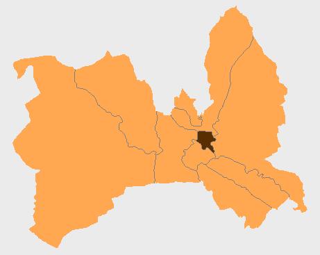
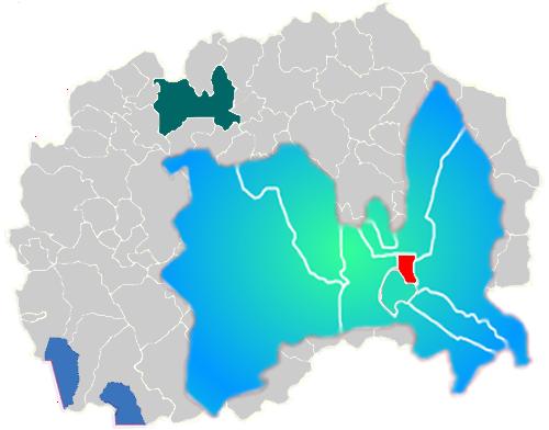


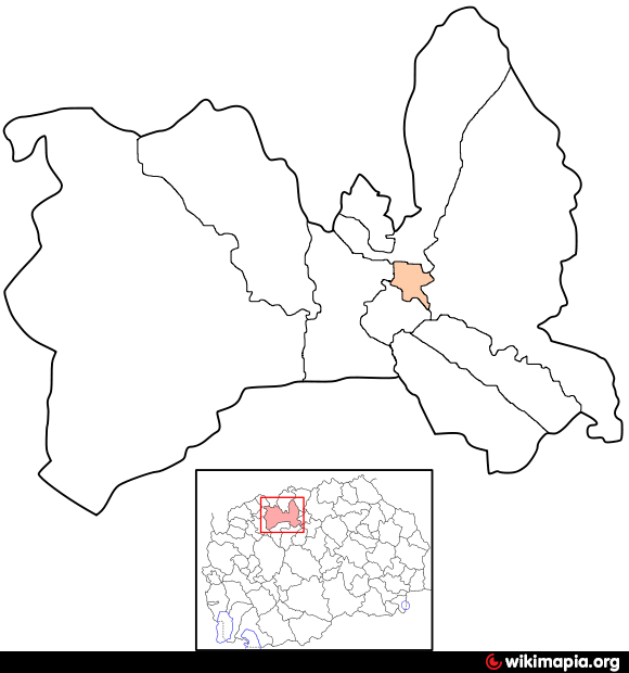
Čair (Macedonian: Чаир, Albanian: Çairi) is one of the 10 municipalities that make up the city of Skopje, the capital of the Republic of North Macedonia. Skopje's old town is located in Čair.
Čair is located along the eastern bank of the Vardar River, opposite the modern city center. It borders Centar Municipality to the southwest, Karpoš Municipality to the west, Butel Municipality to the north, and Gazi Baba Municipality to the east.
Skopje's old town, or Stara Čaršija, had been the city's main center at least since the 12th century. Turkish influence is dominant in the Stara Čaršija. The old town has not changed much over time; it is still filled with narrow cobblestone walkways and most of the Ottoman monuments are still standing.
According to the last national census from 2002, Čair has 64,773 inhabitants.
Ethnic groups in the municipality include:
* Albanians = 36,921
* Macedonians = 15,628
* Turks = 4,500
* Roma = 3,083
* Bosniaks = 2,950
* others.
cair.gov.mk
www.facebook.com/komunacair
Wikipedia article: http://en.wikipedia.org/wiki/Čair_Municipality
Nearby cities:
Coordinates: 42°0'38"N 21°26'21"E
- Municipality of Prilep 61 km
- Municipality of Kavadarci 62 km
- Municipality of Kuršumlija 147 km
- Knjaževac Municipality 197 km
- Podgorica Capital City 213 km
- Zaječar Municipality 247 km
- Municipality of Pljevlja 269 km
- Municipality of Nikshic 274 km
- Trebinje Minicipality 303 km
- Municipality of Sabac 368 km
- Gazi Babа 0.7 km
- Topansko Pole 0.9 km
- Gradishte 1 km
- ANM - Ilinden 1.8 km
- City Park 1.8 km
- Debar Maalo 1.8 km
- Center 2 km
- Bunjakovec 2.3 km
- City of Skopje 5.6 km
- Vodno Mt. 6.3 km
Comments