Tree Tunnel (Koloa)
USA /
Hawaii /
Omao /
World
/ USA
/ Hawaii
/ Omao
World
tree, tunnel
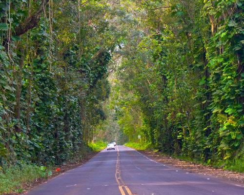
A roadway with big trees on both sides.
Nearby cities:
Coordinates: 21°56'45"N 159°28'0"W
- Founders Grove 3918 km
- Oak Grove Regional Park 4049 km
- Terminal Forest Products, Terminal Sawmill division 4405 km
- Teal-Jones Group Surrey mill site 4426 km
- Silver Creek Premium Products 4446 km
- Gilbert Smith Forest Products 4696 km
- Lone Tree Mountain 4758 km
- Pando 4883 km
- San Bernard Oak 6392 km
- EL TULE 6571 km
- Lihue-Koloa Forest Reserve - Southern Section 5.2 km
- Kalaheo, Hawaii 6.4 km
- Agribusiness Development Corporation - Kalepa Agricultural Lands 13 km
- Kauaʻi 14 km
- Lihue-Koloa Forest Reserve - Northern Section 15 km
- Wainiha Preserve 20 km
- Alaka'i Wilderness Preserve 21 km
- Halelea Forest Reserve 21 km
- Puu Ka Pele Forest Reserve - Eastern Section 21 km
- Na Pali-Kona Forest Reserve - Section 2 24 km
Lihue-Koloa Forest Reserve - Southern Section
Kalaheo, Hawaii
Agribusiness Development Corporation - Kalepa Agricultural Lands
Kauaʻi
Lihue-Koloa Forest Reserve - Northern Section
Wainiha Preserve
Alaka'i Wilderness Preserve
Halelea Forest Reserve
Puu Ka Pele Forest Reserve - Eastern Section
Na Pali-Kona Forest Reserve - Section 2
Comments