Jarablus
Syria /
Hhalab /
Jarabulus /
World
/ Syria
/ Hhalab
/ Jarabulus
, 1 km from center (جرابلس)
town
Add category
Jarabulus (Arabic: جرابلس / ALA-LC: Jarābulus; Aleppo dialect: Jrāblos) is a Syrian city administratively belonging to Aleppo Governorate.
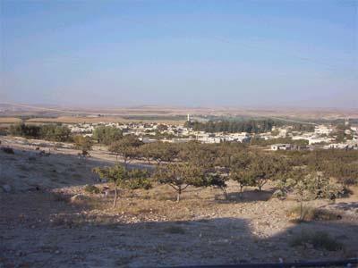
The town has an altitude of 367 m asl and lies on the western bank of the river Euphrates. According to the Syria Central Bureau of Statistics (CBS), it had a population of 11,570 in the 2004 census. It is located North of the Lake Assad, just South of the Syrian-Turkish border. The city has an Arab majority with Kurdish and Turkmen minorities.
The original AD 18th century form of the toponym seems to have been "Djerabis", later found however as "Djeraboolos" or "Djerablus", probably deriving from a Hierapolis (which is modern Manbij to the South-West). In the Bronze and Iron Ages the archaeological site lying just North of Jarabulus (half of which is now in Turkey) was called "Karkemish", in Greek and Roman times the ancient name of the city was "Europos" (Εὐρωπός), which must have been at the origin of the modern form of the toponym Jerabis.
Wikipedia article: https://en.wikipedia.org/wiki/Jarabulus
Nearby cities:
Coordinates: 36°48'40"N 38°0'34"E
- Şahinbey 71 km
- Türkoğlu 140 km
- Doğanşehir 149 km
- Gürün 227 km
- Çamlıyayla (Lambron) 309 km
- Gözne 313 km
- Sarıkaya 389 km
- Kadışehri 408 km
- Şalpazarı 472 km
- Kızılırmak 530 km
- Refugee Camp 0.5 km
- Carchemish Outer Town 1.8 km
- Carchemish (Europos) 1.9 km
- Carchemish Inner Town 2.1 km
- Jarablus plain 3.5 km
- Marma al Hajar mountain (496 m) 7.4 km
- Manbij-Birecik Plain 27 km
- Operation Euphrates Shield 50 km
- Gaziantep Province 74 km
- Şanlıurfa Province 109 km