Wireworks Bridge
| footbridge, Grade II Listed (UK)
United Kingdom /
England /
Tutshill-Sedbury /
Main Road (A466)
World
/ United Kingdom
/ England
/ Tutshill-Sedbury
World / United Kingdom / Wales
footbridge, Grade II Listed (UK)
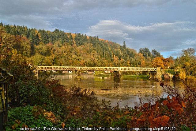
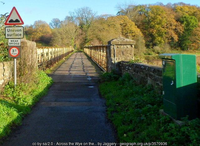
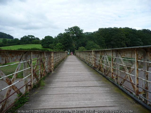
A former railway bridge (dated 1875) which carried the short Tintern Wireworks Branch Line over the river Wye. The branch linked the wire works with the Wye Valley line of the Great Western Railway. Grade II Listed. -Adapted from Wikipedia, Geograph and historicengland.org.uk/listing/the-list/list-entry/1393...
Photos:
1) www.geograph.org.uk/photo/5195172
2) www.geograph.org.uk/photo/3570936
3) www.geograph.org.uk/photo/3090284
Photos:
1) www.geograph.org.uk/photo/5195172
2) www.geograph.org.uk/photo/3570936
3) www.geograph.org.uk/photo/3090284
Wikipedia article: https://en.wikipedia.org/wiki/Tintern_Wireworks_Branch#The_route_today
Nearby cities:
Coordinates: 51°41'57"N 2°40'52"W
- Footbridge 39 km
- Pershore Old Bridge 62 km
- Packington Crossing 72 km
- Foot Bridge 87 km
- King Edwards Drive Bridge 101 km
- Centenary Way 102 km
- Anarchy Bridge 112 km
- Pedestrian Suspension Bridge, Turbine Hall, Coventry Canal 113 km
- Canal Basin Bridge 113 km
- Footbridge 118 km
- Livvox Quarry 3 km
- Devauden 4.7 km
- Chepstow Racecourse 4.9 km
- Mounton Special School 7.4 km
- Sedbury Park Solar Farm 7.4 km
- Rhewl Solar Farm 8.1 km
- Beachley Peninsula 8.9 km
- RAF Caerwent 10 km
- Llanvair Discoed 11 km
- Wentwood Forest 14 km
Comments