Mersea Park (Municipality of Leamington, Ontario)
Canada /
Ontario /
Leamington /
Municipality of Leamington, Ontario
World
/ Canada
/ Ontario
/ Leamington
World / Canada / Ontario / Essex
park
Add category
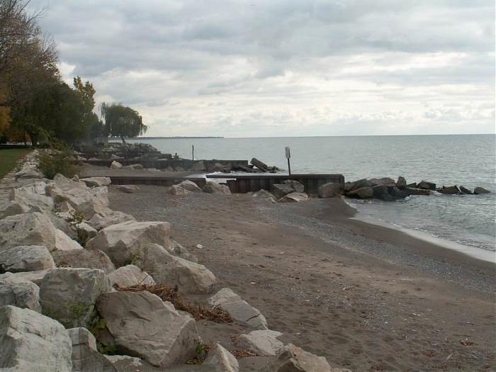
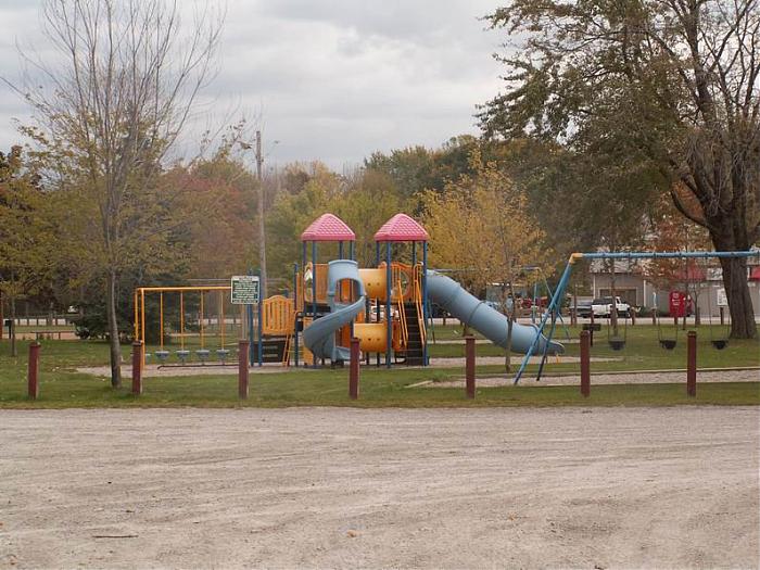
Located on County Road 33 -- on your way to Point Pelee National Park. This community park is approximately 5.85 Ha and is another beautiful location to hold a family get together. This park has a small beach area, 2 baseball diamonds, a large play structure, 2 picnic shelters, washroom facilities and lots of open space to run and enjoy the day. It is recommended to book the picnic sheltersadobe icon in advance.
Nearby cities:
Coordinates: 42°0'29"N 82°34'7"W
- Point Pelee National Park 2.7 km
- FishPoint Nature Preserve 31 km
- Kelleys Island State Park 45 km
- East Harbor State Park 54 km
- Bradley Woods Reservation 82 km
- Cleveland Metroparks - Ohio & Erie Canal Reservation 96 km
- West Creek Reservation 99 km
- Cuyahoga Valley National Park 103 km
- Hinckley Reservation 111 km
- Sand Run Park 126 km
- Erie Shores Golf & Country Club 1.6 km
- Golfwood Lakes 1.8 km
- Caldwell First Nation (Zaaga'iganiniwag) 2.2 km
- Sanctuary Pond 3.6 km
- Leamington Airport 4.1 km
- West Cranberry Pond 5.3 km
- East Cranberry Pond 6.4 km
- Lake Pond 6.6 km
- 42nd Parallel North in Canada 13 km
- Township of Pelee, ON 27 km