Tal Afar Citadel (Tal Afar)
Iraq /
Ninawa /
Tall Afar /
Tal Afar
World
/ Iraq
/ Ninawa
/ Tall Afar
, 1 km from center (تلعفر)
World / Iraq / Ninawa
castle, ruins, citadel, place with historical importance, destroyed
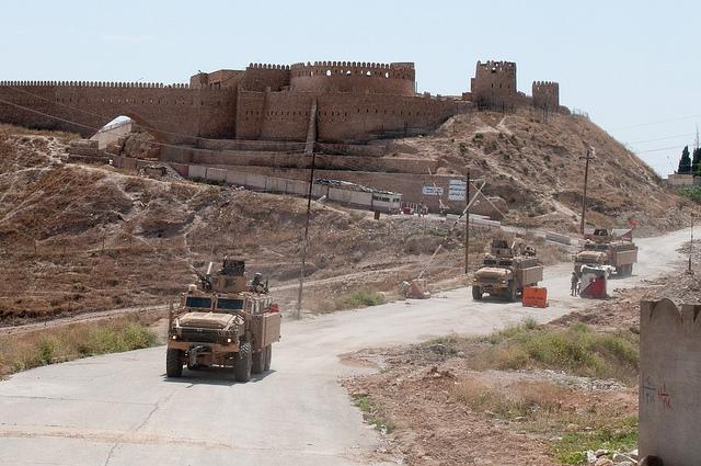
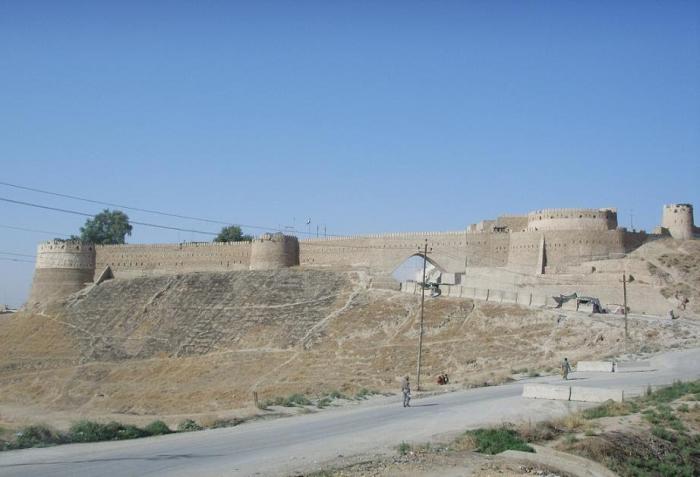
The Tal Afar Citadel (Turkish: Telafer Kalesi) is a citadel located in Tal Afar, a city in Nineveh Governorate in northwest Iraq. The citadel was built by the Ottoman Empire, although it contains remains dating back to the Assyrian period.
Following the 2003 invasion of Iraq, the citadel housed the mayoral, municipal and police headquarters of Tal Afar. It was used as a base by American forces in the Battle of Tal Afar in 2005. Tal Afar fell to the Islamic State of Iraq and the Levant in June 2014, and the militants used the citadel as a prison for women and girls who were to be forcibly married to ISIL members.
In December 2014, ISIL blew up the city's northern and western walls, causing extensive damage. The militants also excavated some of the ruins within the citadel, probably to look for antiquities which they could sell. UNESCO Director-General Irina Bokova strongly condemned the destruction of the citadel.
Wikipedia article: https://en.wikipedia.org/wiki/Tal_Afar_Citadel
Nearby cities:
Coordinates: 36°22'28"N 42°27'15"E
- Mardin Fortress 186 km
- Diyarbakir/Amed Citadel 262 km
- Husn al-Qadisiya (al-Mubarak) Fortress 287 km
- Ancient City of Ercis 299 km
- Balahovit Fortress 341 km
- Divriği Kalesi 507 km
- Al-Husn 587 km
- Սիս / Sis (Sso Berd) 603 km
- Famagusta Castle and Walls, Surici Neighbourhood 782 km
- Arsuf Stronghold - aka Arsur or Apollonia; a Crusader castle 843 km
- Al-Zara'a 2.9 km
- North al-Kefah 4.2 km
- al-Kefah 4.9 km
- Northern Industrial Area 5.5 km
- Sasan mountain (695 m) 7.4 km
- Tall'Afar Air Base 10 km
- East Ashkaft mountain (475 m) 11 km
- Markaz Tal-Afar Subdistrict 13 km
- Zambar-Ibrahim mountain (680 m) 13 km
- Ayadia Subdistrict 19 km