Kandovan
Iran /
Azarbayejan-e Sharqi /
Azar Shahr /
World
/ Iran
/ Azarbayejan-e Sharqi
/ Azar Shahr
, 31 km from center (آذر شهر)
World / Iran / East Azarbaijan
ancient, village, ancient civilization


video :
www.youtube.com/watch?v=-Ym4RJssTD0
.
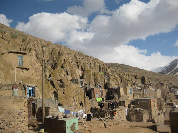
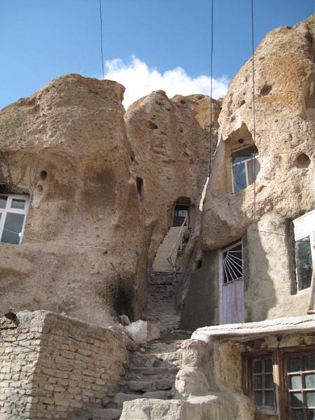
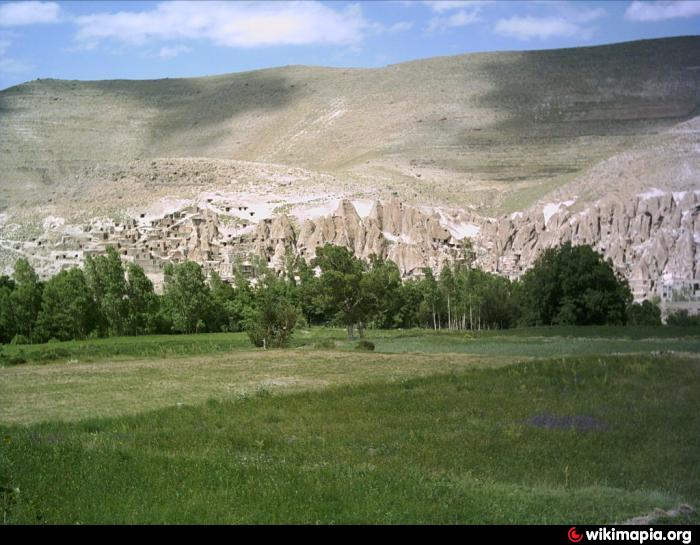
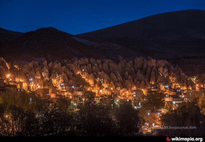
Kandovan (Persian: كندوان, also Romanized as Kandovān and Kandavān; also known as Kanvān) is a village in Sahand Rural District, in the Central District of Osku County, East Azerbaijan Province, Iran. This village is a wonderful example of manmade cliff dwelling which is still inhabited. The troglodyte homes, excavated inside volcanic rocks and tuffs similar to dwellings in the Turkish region of Cappadocia, are locally called “Karaan”. Karaans were cut into the Lahars (volcanic mudflow or debris flow) of Mount Sahand. The cone form of the houses is the result of lahar flow consisting of porous round and angular pumice together with other volcanic particles that were positioned in a grey acidic matrix. After the eruption of Sahand these materials were naturally moved and formed the rocks of Kandovan. Around the village the thickness of this formation exceeds 100 m and with time due to water erosion the cone shaped cliffs were formed.[2] At the 2006 census, the village population was 601, in 168 families.www.youtube.com/watch?v=jcHAb4yFmB8
www.youtube.com/watch?v=-Ym4RJssTD0
.
Kandovan (Persian: كندوان, also Romanized as Kandovān and Kandavān; also known as Kanvān) is a village in Sahand Rural District, in the Central District of Osku County, East Azerbaijan Province, Iran. This village is a wonderful example of manmade cliff dwelling which is still inhabited. The troglodyte homes, excavated inside volcanic rocks and tuffs similar to dwellings in the Turkish region of Cappadocia, are locally called “Karaan”. Karaans were cut into the Lahars (volcanic mudflow or debris flow) of Mount Sahand. The cone form of the houses is the result of lahar flow consisting of porous round and angular pumice together with other volcanic particles that were positioned in a grey acidic matrix. After the eruption of Sahand these materials were naturally moved and formed the rocks of Kandovan. Around the village the thickness of this formation exceeds 100 m and with time due to water erosion the cone shaped cliffs were formed.[2] At the 2006 census, the village population was 601, in 168 families.www.youtube.com/watch?v=jcHAb4yFmB8
Wikipedia article: http://en.wikipedia.org/wiki/Kandovan,_Osku
Nearby cities:
Coordinates: 37°47'40"N 46°14'50"E
- Kojovar 32 km
- Satylly - Satllv 35 km
- Nazarloo 53 km
- Sar kəndi 61 km
- ديزج خليل 62 km
- Tasuj Village 99 km
- Qushchi 110 km
- Valdian 123 km
- Dizaj Diz 132 km
- Evoglu 138 km
- Sahand Protected Area 3.5 km
- Nowo Daghi 3.7 km
- کوه ارشد سلطان - Arshad Sultan Möunt 6.6 km
- The Hoodoos of Zinjanab ... Tent Rocks National Monument 10 km
- Zinjanab mount 11 km
- Sofi Chay Mount 13 km
- Sahand Mountain Range 16 km
- Sofi Chay Protected Area 22 km
- Valley of the Sofi Chay (Maragheh) River 25 km
- Valley of the Mordigh River (Dayti) 41 km
Comments