Smoky Bay
Australia /
South Australia /
Port Lincoln /
World
/ Australia
/ South Australia
/ Port Lincoln
World / Australia / South Australia
town
Add category
Smoky Bay (right)
6.2.1802. Flinders. Smoke from fires seen here.
Smoky Bay History
In 1627, the first white man to sight the shore of Smoky Bay was the Dutchman Peter Nuyts in the ship Gulden Zeepard.
There was to be a gap of 175 years before the west coast was sighted by another white man.
However the bay itself was so named by Captain Matthew Flinders in 1802 when he was sailing westward along the southern coast line of Australia.
He wrote "There was smoke arising from a number of fires on the shore ... (I resolved) ... to give it the name of Smoky Bay"
Imaginative fellow, wasn't he.
The first white people to come to this part of the coast and spend time were the whalers in about 1850-1860. Next to arrive were the station people who took up land to run sheep. Much of the land was scrub, and clearing of the land was needed to be productive.
In 1905 Joe Blumson arrived in Smoky Bay. There was no landing so he rowed in as close to shore as possible then waded the rest of the way. There was an open shed about 50 feet long and a small tin shanty kept by an Afghani. That was Smoky Bay.
In 1911/12, the Grace Boat Darling took 8 days to sail from Adelaide, calling in at Elliston, Streaky Bay, Haslam, Ceduna, Point Sinclair, Fowlers Bay, Denial Bay and Laura Bay before arriving at Smoky Bay to deliver the second teacher to Smoky Bay, Katie Howie.
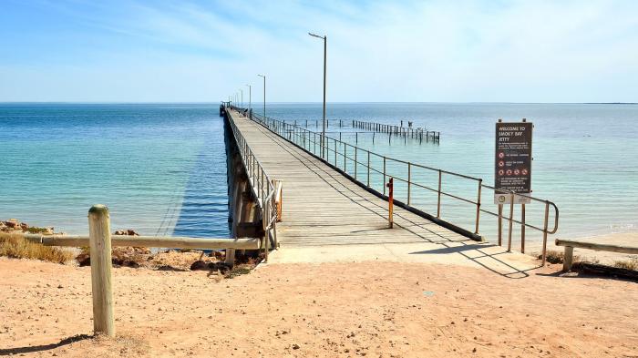
At this stage, the jetty was still being constructed. Freight had to be landed on the beach by cargo boat. Once a month a freight boat came to unload mail, fruit, vegetable and other supplies. The residents were mainly farmers or fishermen in the area.
There are 3 historical buildings in Smoky Bay.
They are now private residences, but until 1927 were part of a vital link between East and West.
The first building was the Postmaster's house, the third housed the staff, while the central building was the hub of activity, being the telegraph repeater and Post Office.
6.2.1802. Flinders. Smoke from fires seen here.
Smoky Bay History
In 1627, the first white man to sight the shore of Smoky Bay was the Dutchman Peter Nuyts in the ship Gulden Zeepard.
There was to be a gap of 175 years before the west coast was sighted by another white man.
However the bay itself was so named by Captain Matthew Flinders in 1802 when he was sailing westward along the southern coast line of Australia.
He wrote "There was smoke arising from a number of fires on the shore ... (I resolved) ... to give it the name of Smoky Bay"
Imaginative fellow, wasn't he.
The first white people to come to this part of the coast and spend time were the whalers in about 1850-1860. Next to arrive were the station people who took up land to run sheep. Much of the land was scrub, and clearing of the land was needed to be productive.
In 1905 Joe Blumson arrived in Smoky Bay. There was no landing so he rowed in as close to shore as possible then waded the rest of the way. There was an open shed about 50 feet long and a small tin shanty kept by an Afghani. That was Smoky Bay.
In 1911/12, the Grace Boat Darling took 8 days to sail from Adelaide, calling in at Elliston, Streaky Bay, Haslam, Ceduna, Point Sinclair, Fowlers Bay, Denial Bay and Laura Bay before arriving at Smoky Bay to deliver the second teacher to Smoky Bay, Katie Howie.
At this stage, the jetty was still being constructed. Freight had to be landed on the beach by cargo boat. Once a month a freight boat came to unload mail, fruit, vegetable and other supplies. The residents were mainly farmers or fishermen in the area.
There are 3 historical buildings in Smoky Bay.
They are now private residences, but until 1927 were part of a vital link between East and West.
The first building was the Postmaster's house, the third housed the staff, while the central building was the hub of activity, being the telegraph repeater and Post Office.
Wikipedia article: http://en.wikipedia.org/wiki/Smoky_Bay,_South_Australia
Nearby cities:
Coordinates: 32°22'29"S 133°56'16"E
- Northam 1633 km
- Collie 1670 km
- Byford, WA 1689 km
- Armadale 1691 km
- Ellenbrook 1696 km
- Forrestdale, WA 1697 km
- Canning Vale, WA 1699 km
- Nambeelup 1704 km
- Wanneroo 1713 km
- Dunsborough 1765 km
- Gascoigne Bay 16 km
- Decres Bay 26 km
- Saint Peter Island 33 km
- Corvisart Bay 51 km
- Isles of St Francis Conservation Park 65 km
- Sceale Bay 70 km
- Port Eyre 138 km
- Flinders Island 159 km
- Nuyts Reefs 170 km
- The longest straight stretch of road in Australia - 145.6 kilometres (90.5 mi) 867 km