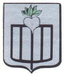
Lokeren
Belgium /
Ost-Flandern /
Lokeren /
World
/ Belgium
/ Ost-Flandern
/ Lokeren
World / Belgium / Vlaanderen / Oost-Vlaanderen / Sint-Niklaas
city, draw only border


Lokeren is located on the Durme (nl), a tributary of the Scheldt, and is the second most important city of the Waasland after Sint-Niklaas. Archaeological finds on the Lokeren territory prove that this area was populated in Neolithic times. A Roman road ran along the Durme river. The name Waas was given to this area by the Romans from the Germanic root Wasu meaning "marshy land". The first mention of the name Lokeren, however, dates from 1114. Unlike the older settlements, the new village came to be built on the right bank of the Durme. By the middle of the 12th century, it had become an independent parish, with agriculture and flax as the two main drivers of the economy. The textile industry would remain important until well into the 20th century.
Wikipedia article: http://en.wikipedia.org/wiki/Lokeren
Nearby cities:
Coordinates: 51°6'40"N 3°58'2"E
- Lokeren (Municipality) 7.7 km
- Sint-Niklaas (Municipality) 11 km
- Lochristi (Municipality) 13 km
- Temse (Municipality) 13 km
- Ghent 21 km
- Evergem (municipality) 25 km
- Zottegem (Municipality) 26 km
- Ninove (municipality) 27 km
- Brakel (municipality) 35 km
- Oudenaarde (municipality) 38 km
- Garage Neyt 0.3 km
- idm in lokeren wacht op awsare 0.3 km
- Pond 0.9 km
- Interflower 1.2 km
- Station Lokeren 1.3 km
- Station Building Lokeren 1.4 km
- Takko Fashion 1.5 km
- Daknam Stadion 1.5 km
- Pond 1.8 km
- Sint-Lodewijkscollege 1.9 km