Gorges of Dobrogea, Geologic Complex - Nature Conservation Area
Romania /
Constanta /
Targusor /
World
/ Romania
/ Constanta
/ Targusor
World / Romania
nature conservation park / area
Add category

Dobrogea Gorges can be accessed on the national road 22 (E87), from Gura Dobrogei or Palazu Mic on the routes: Gura Dobrogea (or Palazu Mic) - Cassian - Cheia - Targusor or Gura Dobrogea - Targusor - Cheia. Another access is from the south direction, from Mihail Kogalniceanu (located on national road 2A/E60), until Targusor (13 km), where you can follow the routes described.
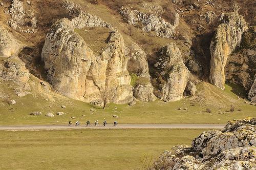
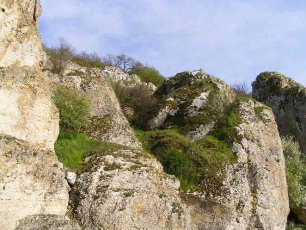
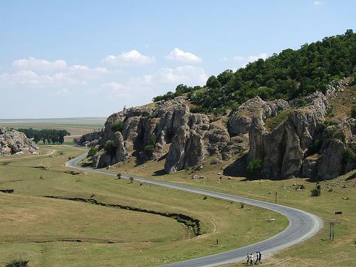
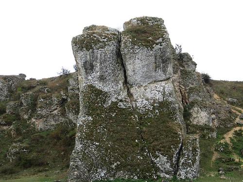
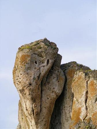
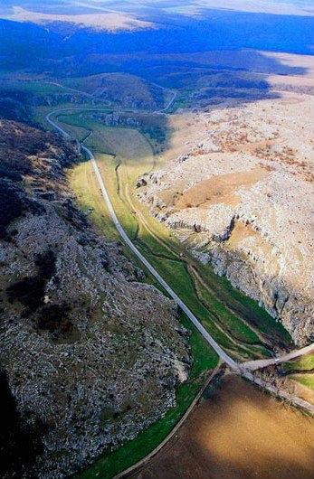
The road from Târguşor to Gradina crosses the canyon sector, with a length of 10 km. Known as Gorges of Dobrogea (Cheile Dobrogei, in romanian), the place impresses by limestone cliffs with height of 60-80 m, a ruiniform appearance relief, with towers, columns, pyramids. The valley is bordered by cylindrical cliffs, with a hard shell and filled with brittle rocks. The so-called atolls form a unique landscape in the country.
These gorges were hardly created by nature and they represent local natural jewels of the Dobrogea region.
MAIN INTERESTS: caves, gorges, small river, water spring, oak forests, coniferous, shrubs, scarce fauna and flora etc.
COORDINATES: N 44.48; E 28.47
ALTITUDE: min. 15; max. 193
TOTAL SURFACE: 11066 ha
Wikipedia article: http://ro.wikipedia.org/wiki/Masivul_Geologic_Cheia
Nearby cities:
Coordinates: 44°29'55"N 28°25'22"E
- Techirghiol Lake 50 km
- Periteasca- Leahova, Danube Delta Biosphere Reserve 54 km
- Muchiile Cernei (Asanlar Ridge) 60 km
- Sacalin-Zatoane protected area 77 km
- "Durankulashko Ezero" PZ Bird Directive 85 km
- Ezero Durankulak PZ Habitat Directive 85 km
- "Shablenski Ezeren Complex" Protected Zone 100 km
- Ezero Shabla - Ezerets PZ 100 km
- Kaliakra PZ 107 km
- "Kompleks Kaliakra" PZ 110 km
- Cheia Quarry 2.1 km
- Grădina commune 4.2 km
- Târguşor commune 4.8 km
- Colţanii de Piatră Hill 10 km
- Cogealac commune 10 km
- Pantelimon commune 12 km
- Siliştea commune 14 km
- Mihail Kogălniceanu commune 16 km
- Crucea commune 18 km
- Vulturu commune 20 km
Comments