Athlone
| town
Ireland /
Westmeath /
Athlone /
World
/ Ireland
/ Westmeath
/ Athlone
World / Republic of Ireland
town
Add category
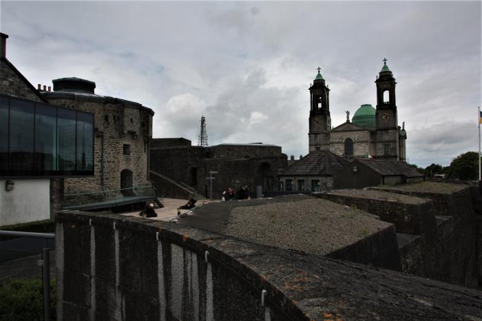
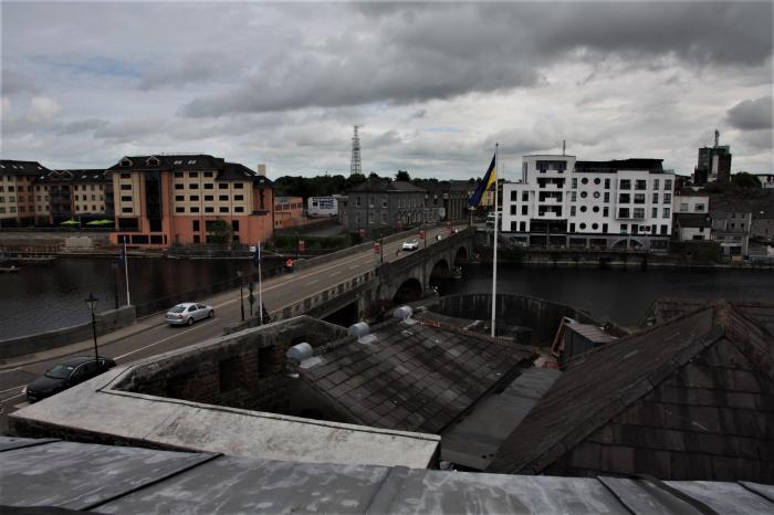
Athlone (Irish: Baile Átha Luain, meaning "town of Luan's ford") is a town on the River Shannon divided between Counties Roscommon and Westmeath, with most of it in Westmeath.
It has a population of 20,000 people and is an important communications hub as it lies at the meeting point of the following primary, secondary, and regional roads: M6, N6, N55, N61, N62, R362, R390, and R446.
Various topographic methods put the geographic centre of Ireland in or near Athlone; the Hill of Uisneach, about 25 km east of Athlone, was considered the ceremonial center of Ireland in Irish mythology.
Wikipedia article: http://en.wikipedia.org/wiki/Athlone
Nearby cities:
Coordinates: 53°25'23"N 7°57'0"W
- Mullingar (Muileann gCearr) 40 km
- Cavan (An Cabhán) 76 km
- Galway 80 km
- Celbridge 90 km
- Ennis (Inis) 94 km
- Dublin 98 km
- Dundalk (Dún Dealgan) 120 km
- Letterkenny (Leitir Ceanainn) 175 km
- Newtownabbey (Baile Úr na Mainistreach) 193 km
- Carrickfergus (Carraig Fhearghais) 201 km
- Hare Island 5.7 km
- Inchmore Island (Inis Mhór) 9 km
- Mongan Bog 11 km
- Lough Funshinagh / Loch Fuinseann 14 km
- Lough Ree (Loch Rí) 15 km
- County Westmeath (Contae na hIarmhí) 35 km
- County Longford (Contae Longfoirt) 38 km
- County Roscommon (Contae Ros Comain) 40 km
- County Offaly (Contae Uíbh Fhailí) 42 km
- County Galway (Contae na Gaillimhe) 76 km
Comments