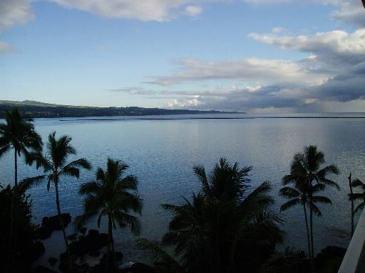
Hilo Bay
| harbor
USA /
Hawaii /
Wainaku /
World
/ USA
/ Hawaii
/ Wainaku
World / United States / Hawaii
bay, invisible, harbor


Hilo Harbor's basin measures 1,400=feet wide by 2,300-feet long, protected by a 10,000-foot breakwater. The depth in the entrance channel is 35'. [hidot.hawaii.gov/harbors/files/2012/10/Hilo-Harbor-Hawa...]
Hilo Bay has an entrance width of 8 miles between Pepeekeo Point on the N and Leleiwi Point on the SE; the head of the bay is 4 miles inland. Hilo, on the SW side of the bay, is second in importance of the commercial deepwater harbors in the State of Hawaii. The W shore of Hilo Bay is bluff, but the S and SE shores are low. The outer bay is exposed to the NE trades, but the inner harbor is protected by a breakwater on Blonde Reef. There is frequently a heavy swell which is deflected E by the W shore and causes considerable surge at the wharves behind the breakwater. The W end of the breakwater is marked by a light. From deep water on the N, the channel to the inner
harbor leads between the breakwater and the W shore, then turns sharply E and follows the S edge of Blonde Reef to the wharves in Kūhiō Bay. A Federal project provides for an entrance channel 35 feet deep and a harbor basin of same depth in Kūhiō Bay. Channel and basin are maintained at or near the project depth. The entrance and channel to the basin are marked by a directional light on Coconut Point, lighted and unlighted buoys, and a 097.2° lighted range leading into Kūhiō Bay. The range may be obscured by vessels moored at Pier 1. Anchorages may be obtained anywhere under the lee of the breakwater where depths are suitable. Good anchorage is available W of Kaula‘ināiwi Island in depths of 25 to 35 feet over good holding ground. Well protected small-craft anchorages with fair holding ground may be found in S of Kūhiō Bay, and in Radio Bay E of Pier 1. The Hilo harbormaster usually assigns deep-draft anchorages. Special anchorages are on the S side of Hilo Bay and in the E part of Kūhiō Bay at the S end of the breakwater. A NNW current of about 1 knot has been reported in the approach to the harbor. After heavy rains, currents from Wailoa River and Wailuku River set N in the inner harbor.
[www.nauticalcharts.noaa.gov/nsd/coastpilot_w.php?book=7] Chapter 14
The Hilo Deep Draft Harbor is located on the northeast coast of the island of Hawaii, the State’s southernmost island. The project was initially authorized under the River and Harbor Act of 1907, subsequent work was authorized under the River and Harbor Act of 1912 and 1925. The project was completed in 1930 and consists of a 10,080-foot-long breakwater protecting a 35-foot-deep basin. The local sponsor is the State of Hawaii, Department of Transportation, Harbors Division. Hilo Harbor is one of the two main commercial ports for the Island of Hawaii and is more than 70 miles from Kawaihae Harbor that serves the west side of the island.
[www.poh.usace.army.mil/Missions/CivilWorks/CivilWorksPr...]
NOAA hydrographic charts may be found online at:
www.charts.noaa.gov/OnLineViewer/19324.shtml
geographic.org/nautical_charts/40_hawaiian_islands_and_...
www.nauticalchartsonline.com/chart/zoom?chart=19324
www.oceangrafix.com/chart/detail/19324-Island-Of-Hawaii...
Wikipedia article: http://en.wikipedia.org/wiki/Hilo_Bay
Nearby cities:
Coordinates: 19°44'3"N 155°3'53"W
- Kawaihae Bay 89 km
- Kanapou Bay 181 km
- South Maui 193 km
- Ma'alaea Bay 194 km
- Maunalua Bay 333 km
- Kaneohe Bay 345 km
- Ke'ehi Lagoon 347 km
- East Loch 354 km
- West Loch 358 km
- Māmala Bay 363 km
- Waiākea Peninsula 0.9 km
- Hilo International Airport (IATA: ITO, ICAO: PHTO) 2.7 km
- Keaukaha Hawaiian Home Land 4.8 km
- Puueo Farm Lots 6.3 km
- Papa'ikou, Hawaii 6.9 km
- Kaapoko Homesteads 7.3 km
- Humu'ula-Lower Piihonua Hawaiian Home Land 8.6 km
- Kaieie Homesteads 8.9 km
- Kaiwiki Homesteads I & II 10 km
- Hawai‘i 42 km