CSX/B&O Halethorpe Interlocking (HX Tower) - relocated
USA /
Maryland /
Arbutus /
World
/ USA
/ Maryland
/ Arbutus
World / United States / Virginia
railway, interlocking tower
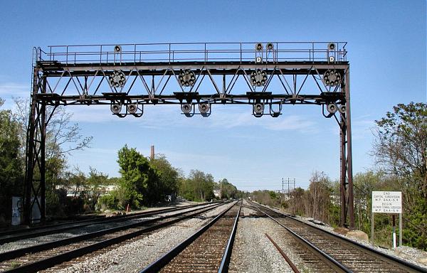
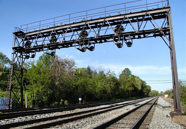
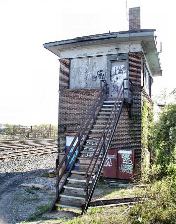
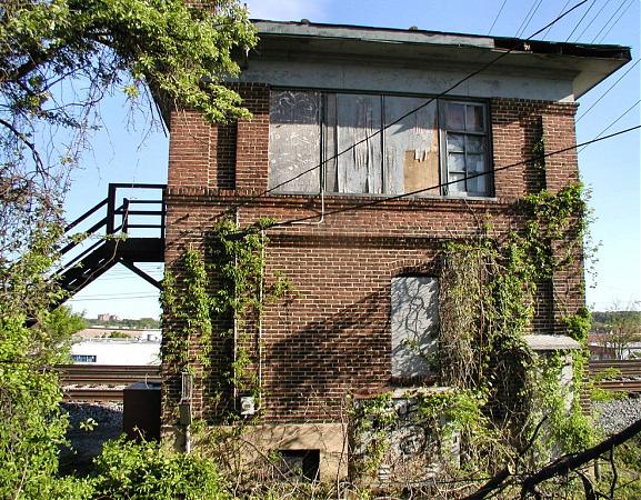
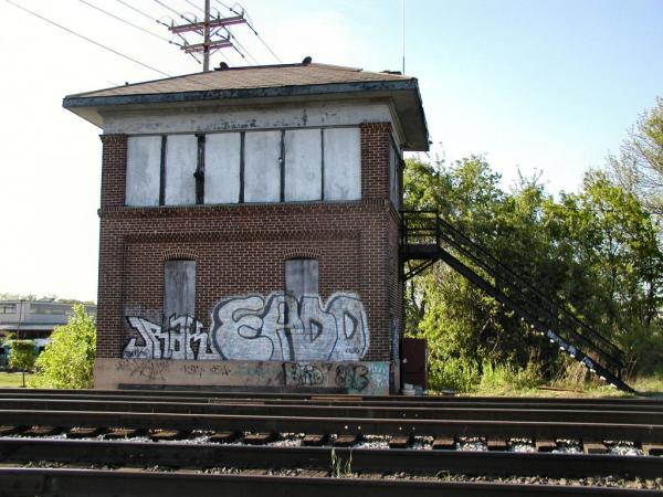
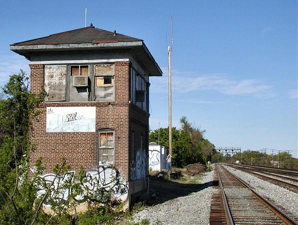
Halethorpe was a major B&O Railroad interlocking tower. South and west bound traffic was switched between the Old Main Line and the Washington Branch at the Halethorpe Interlock. HX Tower was built in 1917, closed Oct. 1, 1985, and remains the last surviving control tower on the Old Main Line.
HX tower demarks the beginning of the CSX Old Main Line Subdivision, extending 59 miles west to Point of Rocks, MD and presided over a 4-track full crossover with B&O CPL gantries at each end. The interlocking was removed and relocated about .5 miles to the south at St Denis in conjunction with a capacity improvement project.
The CSX Baltimore Terminal Service Center (BTSC) in the CANCO building at the corner of Halethorpe Farms Rd and Hollins Ferry Rd closed when dispatch operations were centralized in Jacksonville, FL. CSX returned its local dispatch operations to Baltimore on June 21, 2008 when it opened its new Baltimore Dispatch Center in the former Carling Brewery plant on the southwest side of the Baltimore Beltway.
rides.webshots.com/photo/1136605641054856954OhogvL
www.railroadsignals.us/baltimore/map7.htm
Nearby cities:
Coordinates: 39°13'46"N 76°41'9"W
- Norfolk Southern Bayview Yard 14 km
- PRR Bowie Race Track Spur (Abandoned) 23 km
- RF&P / PRR Potomac Yard 52 km
- Former route of Washington & Old Dominion Railroad 55 km
- Former right of way of the Washington-Virginia Railway 65 km
- Emmitsburg Railroad (Abandoned) 77 km
- Lancaster, Octoraro & Susquehanna Railroad (Abandoned) 78 km
- Amtrak/PRR 25Hz Power Transmission Lines 82 km
- East Berlin Railroad - Abandoned 84 km
- Pennsylvania Railroad - Frederick to Hanover (Mostly Abandoned) 89 km
- Arbutus, Maryland 1.3 km
- Linthicum, Maryland 2.9 km
- Patapsco Valley State Park 5.8 km
- Elkridge, Maryland 6.2 km
- Catonsville, Maryland 6.4 km
- Glen Burnie, Maryland 10 km
- Severn, Maryland 11 km
- Howard County, Maryland 22 km
- Baltimore County, Maryland 25 km
- Anne Arundel County, Maryland 29 km