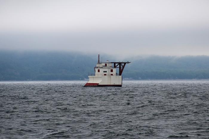
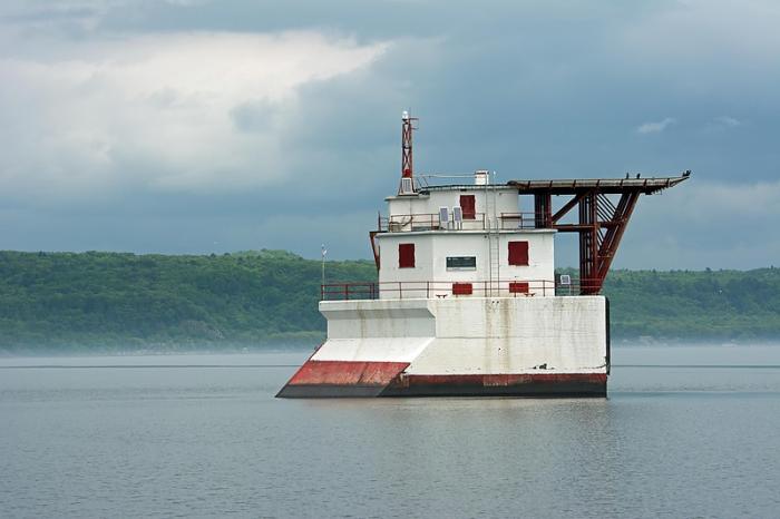
Gros Cap Reef light
Canada /
Ontario /
Sault Sainte Marie /
World
/ Canada
/ Ontario
/ Sault Sainte Marie
World / Canada / Ontario / Lake Superior
lighthouse
Add category
www.lighthousefriends.com/light.asp?ID=1114
marinas.com/view/lighthouse/667_Gros_Cap_Reefs_Light_Sa...
Location: Located on the southwest part of the reef, between Point Iroquois and Gros Cap and near the entrance to the St. Marys River from Lake Superior.
Latitude: 46.51213
Longitude: -84.61524
Format DD DMS
Body of water Mary's River
Height Above Water 59 feet
Light Characteristics Flashing red every 5 seconds, visible for 12 miles
Address Whitefish Bay, Entrance to St. Mary's River, Lake Superior
Sault Ste. Marie, ON
Canada
Wikipedia article: http://en.wikipedia.org/wiki/Gros_Cap_Reefs_Light
Nearby cities:
Coordinates: 46°30'43"N 84°36'54"W
- White Shoal Lighthouse 85 km
- Grays Reef Lighthouse 93 km
- Lansing Shoal Lighthouse 100 km
- Stannard Rock Island and Lighthouse 213 km
- Plum Island Range Lights 226 km
- Green Island 277 km
- Bustard Rocks lighthouses 290 km
- Little Point Sable 352 km
- The Village of Rosseau 409 km
- Detroit River Lighthouse 515 km
- Township of Prince 7.9 km
- Bay Mills Reservation 8.5 km
- Izaak Walton Bay 13 km
- Prince Township Wind Farm 15 km
- Whitefish bay 16 km
- Sault-Sainte-Marie (City Center) 22 km
- Tahquamenon Bay 30 km
- Chippewa County International Airport (CIU/KCIU) (formerly Kincheloe AFB) 32 km
- Hiawatha National Forest (Eastside) 40 km
- Tahquamenon Falls State Park 43 km